W56A Indian Trail, NC, USA - Earthquake Result Viewer
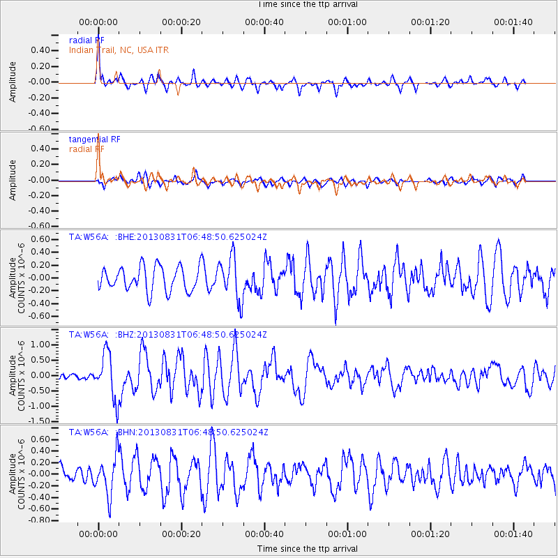
Earthquake location: Andreanof Islands, Aleutian Is.
Earthquake latitude/longitude: 51.2/-174.9
Earthquake time(UTC): 2013/08/31 (243) 06:38:36 GMT
Earthquake Depth: 18 km
Earthquake Magnitude: 6.0 MWW, 5.5 ML, 5.9 MWB, 5.9 MWC, 6.0 MWC, 6.0 MI, 6.0 MWW
Earthquake Catalog/Contributor: NEIC PDE/NEIC COMCAT
Network: TA USArray Transportable Network (new EarthScope stations)
Station: W56A Indian Trail, NC, USA
Lat/Lon: 35.13 N/80.58 W
Elevation: 177 m
Distance: 66.0 deg
Az: 63.436 deg
Baz: 316.683 deg
Ray Param: 0.057872504
Estimated Moho Depth: 31.75 km
Estimated Crust Vp/Vs: 1.72
Assumed Crust Vp: 6.419 km/s
Estimated Crust Vs: 3.743 km/s
Estimated Crust Poisson's Ratio: 0.24
Radial Match: 80.54906 %
Radial Bump: 400
Transverse Match: 62.466934 %
Transverse Bump: 400
SOD ConfigId: 626651
Insert Time: 2014-04-18 06:43:02.019 +0000
GWidth: 2.5
Max Bumps: 400
Tol: 0.001

Signal To Noise

ChannelStoNSTALTA
TA:W56A: :BHZ:20130831T06:48:50.625024Z5.73472747.6218026E-71.329061E-7
TA:W56A: :BHN:20130831T06:48:50.625024Z2.66683633.4621868E-71.2982375E-7
TA:W56A: :BHE:20130831T06:48:50.625024Z1.84093133.4729248E-71.8865043E-7
Arrivals
Ps3.7 SECOND
PpPs13 SECOND
PsPs/PpSs17 SECOND