
W57A Gilead, NC, USA - Earthquake Result Viewer
| ||||||||||||||||||
| ||||||||||||||||||
| ||||||||||||||||||
|
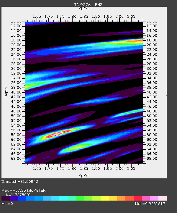
Signal To Noise
| Channel | StoN | STA | LTA |
| TA:W57A: :BHZ:20130831T06:48:52.649988Z | 5.843502 | 8.5814884E-7 | 1.4685523E-7 |
| TA:W57A: :BHN:20130831T06:48:52.649988Z | 2.7846549 | 3.2415352E-7 | 1.16407065E-7 |
| TA:W57A: :BHE:20130831T06:48:52.649988Z | 2.274815 | 3.7956264E-7 | 1.6685429E-7 |
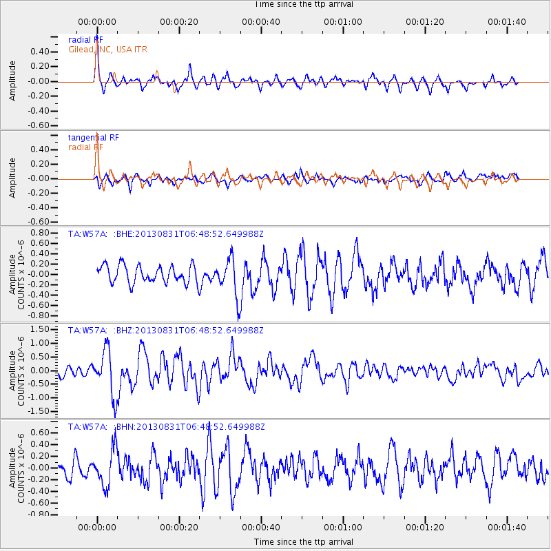
| Arrivals | |
| Ps | 6.7 SECOND |
| PpPs | 23 SECOND |
| PsPs/PpSs | 30 SECOND |

