You are here: Home > Network List > TA - USArray Transportable Network (new EarthScope stations) Stations List
> Station W59A Clinton, NC, USA > Earthquake Result Viewer
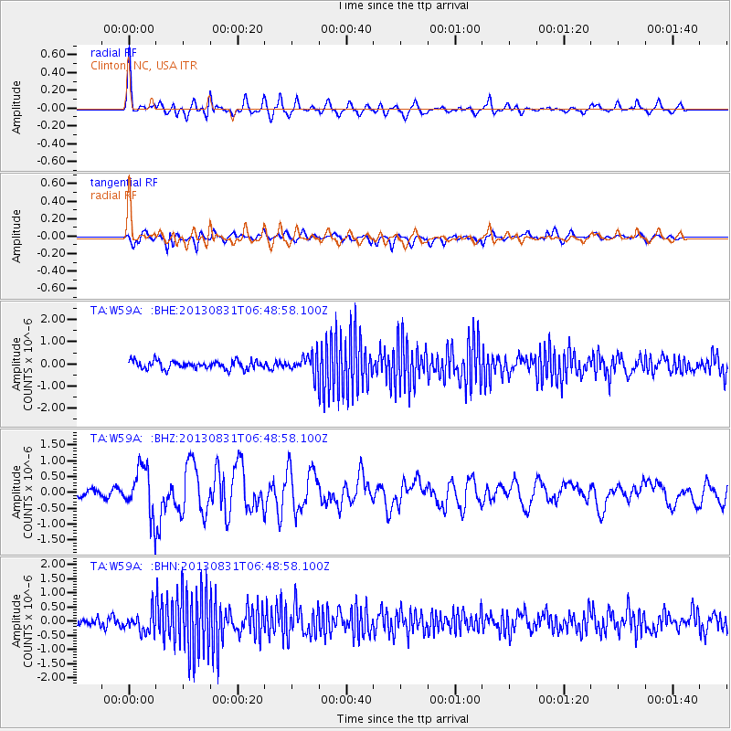
W59A Clinton, NC, USA - Earthquake Result Viewer
*The percent match for this event was below the threshold and hence no stack was calculated.
| Earthquake location: |
Andreanof Islands, Aleutian Is. |
| Earthquake latitude/longitude: |
51.2/-174.9 |
| Earthquake time(UTC): |
2013/08/31 (243) 06:38:36 GMT |
| Earthquake Depth: |
18 km |
| Earthquake Magnitude: |
6.0 MWW, 5.5 ML, 5.9 MWB, 5.9 MWC, 6.0 MWC, 6.0 MI, 6.0 MWW |
| Earthquake Catalog/Contributor: |
NEIC PDE/NEIC COMCAT |
|
| Network: |
TA USArray Transportable Network (new EarthScope stations) |
| Station: |
W59A Clinton, NC, USA |
| Lat/Lon: |
35.17 N/78.44 W |
| Elevation: |
60 m |
|
| Distance: |
67.2 deg |
| Az: |
62.015 deg |
| Baz: |
317.345 deg |
| Ray Param: |
$rayparam |
*The percent match for this event was below the threshold and hence was not used in the summary stack. |
|
| Radial Match: |
71.90137 % |
| Radial Bump: |
400 |
| Transverse Match: |
67.3825 % |
| Transverse Bump: |
400 |
| SOD ConfigId: |
626651 |
| Insert Time: |
2014-04-18 06:43:09.645 +0000 |
| GWidth: |
2.5 |
| Max Bumps: |
400 |
| Tol: |
0.001 |
|
Signal To Noise
| Channel | StoN | STA | LTA |
| TA:W59A: :BHZ:20130831T06:48:58.100Z | 6.6026497 | 7.5665804E-7 | 1.14599146E-7 |
| TA:W59A: :BHN:20130831T06:48:58.100Z | 1.8045728 | 3.5173633E-7 | 1.9491391E-7 |
| TA:W59A: :BHE:20130831T06:48:58.100Z | 2.2180893 | 4.0830838E-7 | 1.8408113E-7 |
| Arrivals |
| Ps | |
| PpPs | |
| PsPs/PpSs | |


