YACT Amboy, WA, USA - Earthquake Result Viewer
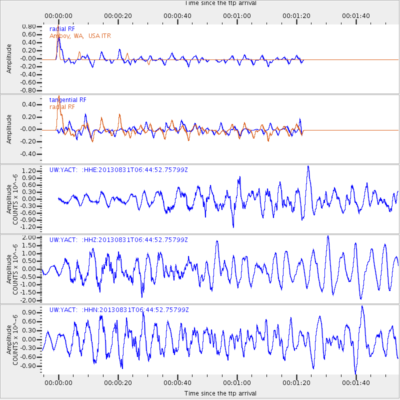
Earthquake location: Andreanof Islands, Aleutian Is.
Earthquake latitude/longitude: 51.2/-174.9
Earthquake time(UTC): 2013/08/31 (243) 06:38:36 GMT
Earthquake Depth: 18 km
Earthquake Magnitude: 6.0 MWW, 5.5 ML, 5.9 MWB, 5.9 MWC, 6.0 MWC, 6.0 MI, 6.0 MWW
Earthquake Catalog/Contributor: NEIC PDE/NEIC COMCAT
Network: UW Pacific Northwest Regional Seismic Network
Station: YACT Amboy, WA, USA
Lat/Lon: 45.93 N/122.42 W
Elevation: 211 m
Distance: 34.5 deg
Az: 77.778 deg
Baz: 298.318 deg
Ray Param: 0.07768039
Estimated Moho Depth: 47.25 km
Estimated Crust Vp/Vs: 2.10
Assumed Crust Vp: 6.566 km/s
Estimated Crust Vs: 3.13 km/s
Estimated Crust Poisson's Ratio: 0.35
Radial Match: 81.88713 %
Radial Bump: 400
Transverse Match: 62.964428 %
Transverse Bump: 400
SOD ConfigId: 626651
Insert Time: 2014-04-18 06:48:43.990 +0000
GWidth: 2.5
Max Bumps: 400
Tol: 0.001

Signal To Noise

ChannelStoNSTALTA
UW:YACT: :HHZ:20130831T06:44:52.75799Z2.59226634.1235285E-71.590704E-7
UW:YACT: :HHN:20130831T06:44:52.75799Z1.53491542.4955924E-71.6258828E-7
UW:YACT: :HHE:20130831T06:44:52.75799Z1.70131112.3932353E-71.4067005E-7
Arrivals
Ps8.5 SECOND
PpPs21 SECOND
PsPs/PpSs29 SECOND