You are here: Home > Network List > TA - USArray Transportable Network (new EarthScope stations) Stations List
> Station D51A Lot 18 Range III Mazenod Township, QC, CAN > Earthquake Result Viewer
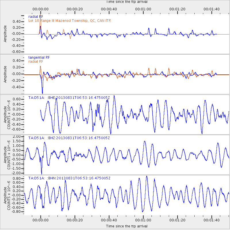
D51A Lot 18 Range III Mazenod Township, QC, CAN - Earthquake Result Viewer
*The percent match for this event was below the threshold and hence no stack was calculated.
| Earthquake location: |
Andreanof Islands, Aleutian Is. |
| Earthquake latitude/longitude: |
51.4/-175.3 |
| Earthquake time(UTC): |
2013/08/31 (243) 06:43:54 GMT |
| Earthquake Depth: |
25 km |
| Earthquake Magnitude: |
5.5 MW, 5.5 MWC, 5.5 MWC |
| Earthquake Catalog/Contributor: |
NEIC PDE/NEIC COMCAT |
|
| Network: |
TA USArray Transportable Network (new EarthScope stations) |
| Station: |
D51A Lot 18 Range III Mazenod Township, QC, CAN |
| Lat/Lon: |
47.09 N/79.37 W |
| Elevation: |
282 m |
|
| Distance: |
58.3 deg |
| Az: |
52.979 deg |
| Baz: |
312.903 deg |
| Ray Param: |
$rayparam |
*The percent match for this event was below the threshold and hence was not used in the summary stack. |
|
| Radial Match: |
37.516304 % |
| Radial Bump: |
400 |
| Transverse Match: |
77.49353 % |
| Transverse Bump: |
400 |
| SOD ConfigId: |
626651 |
| Insert Time: |
2014-04-18 07:04:14.114 +0000 |
| GWidth: |
2.5 |
| Max Bumps: |
400 |
| Tol: |
0.001 |
|
Signal To Noise
| Channel | StoN | STA | LTA |
| TA:D51A: :BHZ:20130831T06:53:16.475005Z | 1.9846451 | 9.527754E-7 | 4.800734E-7 |
| TA:D51A: :BHN:20130831T06:53:16.475005Z | 1.0751851 | 4.172901E-7 | 3.8811004E-7 |
| TA:D51A: :BHE:20130831T06:53:16.475005Z | 0.9692334 | 3.356268E-7 | 3.4628067E-7 |
| Arrivals |
| Ps | |
| PpPs | |
| PsPs/PpSs | |


