You are here: Home > Network List > TA - USArray Transportable Network (new EarthScope stations) Stations List
> Station T52A Hallie, KY, USA > Earthquake Result Viewer
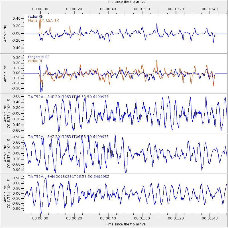
T52A Hallie, KY, USA - Earthquake Result Viewer
*The percent match for this event was below the threshold and hence no stack was calculated.
| Earthquake location: |
Andreanof Islands, Aleutian Is. |
| Earthquake latitude/longitude: |
51.4/-175.3 |
| Earthquake time(UTC): |
2013/08/31 (243) 06:43:54 GMT |
| Earthquake Depth: |
25 km |
| Earthquake Magnitude: |
5.5 MW, 5.5 MWC, 5.5 MWC |
| Earthquake Catalog/Contributor: |
NEIC PDE/NEIC COMCAT |
|
| Network: |
TA USArray Transportable Network (new EarthScope stations) |
| Station: |
T52A Hallie, KY, USA |
| Lat/Lon: |
37.11 N/82.99 W |
| Elevation: |
436 m |
|
| Distance: |
63.4 deg |
| Az: |
63.31 deg |
| Baz: |
315.525 deg |
| Ray Param: |
$rayparam |
*The percent match for this event was below the threshold and hence was not used in the summary stack. |
|
| Radial Match: |
51.26108 % |
| Radial Bump: |
400 |
| Transverse Match: |
71.69753 % |
| Transverse Bump: |
400 |
| SOD ConfigId: |
626651 |
| Insert Time: |
2014-04-18 07:08:21.754 +0000 |
| GWidth: |
2.5 |
| Max Bumps: |
400 |
| Tol: |
0.001 |
|
Signal To Noise
| Channel | StoN | STA | LTA |
| TA:T52A: :BHZ:20130831T06:53:50.649993Z | 1.6181297 | 5.9753216E-7 | 3.6927332E-7 |
| TA:T52A: :BHN:20130831T06:53:50.649993Z | 2.2611125 | 6.641199E-7 | 2.9371378E-7 |
| TA:T52A: :BHE:20130831T06:53:50.649993Z | 0.6704757 | 2.2323681E-7 | 3.3295285E-7 |
| Arrivals |
| Ps | |
| PpPs | |
| PsPs/PpSs | |


