NOUC Port Laguerre, New Caledonia - Earthquake Result Viewer
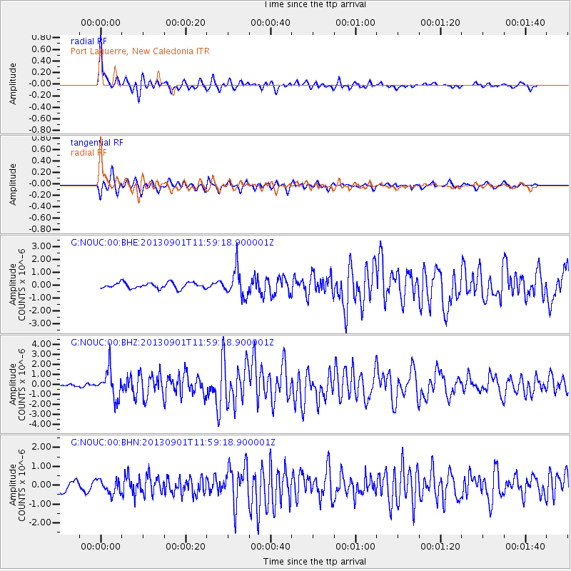
Earthquake location: Banda Sea
Earthquake latitude/longitude: -7.4/128.2
Earthquake time(UTC): 2013/09/01 (244) 11:52:29 GMT
Earthquake Depth: 112 km
Earthquake Magnitude: 6.5 MWW, 6.4 MWC, 6.4 MWD, 6.5 MWW, 6.5 MWB, 6.5 MWC
Earthquake Catalog/Contributor: NEIC PDE/NEIC COMCAT
Network: G GEOSCOPE
Station: NOUC Port Laguerre, New Caledonia
Lat/Lon: 22.10 S/166.30 E
Elevation: 112 m
Distance: 39.5 deg
Az: 115.844 deg
Baz: 285.767 deg
Ray Param: 0.07457771
Estimated Moho Depth: 26.25 km
Estimated Crust Vp/Vs: 1.70
Assumed Crust Vp: 5.14 km/s
Estimated Crust Vs: 3.028 km/s
Estimated Crust Poisson's Ratio: 0.23
Radial Match: 90.492226 %
Radial Bump: 398
Transverse Match: 88.27411 %
Transverse Bump: 400
SOD ConfigId: 626651
Insert Time: 2014-04-18 07:18:28.279 +0000
GWidth: 2.5
Max Bumps: 400
Tol: 0.001

Signal To Noise

ChannelStoNSTALTA
G:NOUC:00:BHZ:20130901T11:59:18.900001Z10.7398921.4408093E-61.3415492E-7
G:NOUC:00:BHN:20130901T11:59:18.900001Z1.88683443.658459E-71.9389401E-7
G:NOUC:00:BHE:20130901T11:59:18.900001Z4.7650761.0713125E-62.248259E-7
Arrivals
Ps3.7 SECOND
PpPs13 SECOND
PsPs/PpSs17 SECOND