AAK Ala Archa, Kyrgyzstan - Earthquake Result Viewer
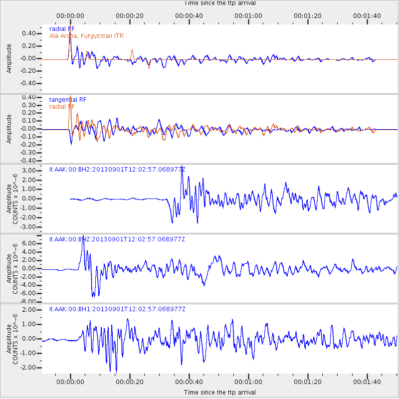
Earthquake location: Banda Sea
Earthquake latitude/longitude: -7.4/128.2
Earthquake time(UTC): 2013/09/01 (244) 11:52:29 GMT
Earthquake Depth: 112 km
Earthquake Magnitude: 6.5 MWW, 6.4 MWC, 6.4 MWD, 6.5 MWW, 6.5 MWB, 6.5 MWC
Earthquake Catalog/Contributor: NEIC PDE/NEIC COMCAT
Network: II Global Seismograph Network (GSN - IRIS/IDA)
Station: AAK Ala Archa, Kyrgyzstan
Lat/Lon: 42.64 N/74.49 E
Elevation: 1645 m
Distance: 69.7 deg
Az: 320.647 deg
Baz: 121.55 deg
Ray Param: 0.055151157
Estimated Moho Depth: 16.5 km
Estimated Crust Vp/Vs: 1.90
Assumed Crust Vp: 6.306 km/s
Estimated Crust Vs: 3.315 km/s
Estimated Crust Poisson's Ratio: 0.31
Radial Match: 93.36378 %
Radial Bump: 400
Transverse Match: 93.54191 %
Transverse Bump: 400
SOD ConfigId: 626651
Insert Time: 2014-04-18 07:19:54.652 +0000
GWidth: 2.5
Max Bumps: 400
Tol: 0.001

Signal To Noise

ChannelStoNSTALTA
II:AAK:00:BHZ:20130901T12:02:57.068977Z55.0821882.864589E-65.2005728E-8
II:AAK:00:BH1:20130901T12:02:57.068977Z5.0150612.2492338E-74.4849582E-8
II:AAK:00:BH2:20130901T12:02:57.068977Z15.2192648.8133595E-75.790924E-8
Arrivals
Ps2.4 SECOND
PpPs7.3 SECOND
PsPs/PpSs9.8 SECOND