NIL Nilore, Pakistan - Earthquake Result Viewer
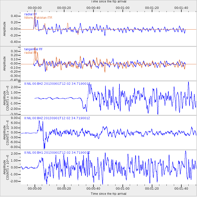
Earthquake location: Banda Sea
Earthquake latitude/longitude: -7.4/128.2
Earthquake time(UTC): 2013/09/01 (244) 11:52:29 GMT
Earthquake Depth: 112 km
Earthquake Magnitude: 6.5 MWW, 6.4 MWC, 6.4 MWD, 6.5 MWW, 6.5 MWB, 6.5 MWC
Earthquake Catalog/Contributor: NEIC PDE/NEIC COMCAT
Network: II Global Seismograph Network (GSN - IRIS/IDA)
Station: NIL Nilore, Pakistan
Lat/Lon: 33.65 N/73.27 E
Elevation: 629 m
Distance: 66.2 deg
Az: 311.707 deg
Baz: 117.431 deg
Ray Param: 0.05749316
Estimated Moho Depth: 15.25 km
Estimated Crust Vp/Vs: 1.75
Assumed Crust Vp: 6.242 km/s
Estimated Crust Vs: 3.572 km/s
Estimated Crust Poisson's Ratio: 0.26
Radial Match: 88.91839 %
Radial Bump: 400
Transverse Match: 73.124374 %
Transverse Bump: 400
SOD ConfigId: 626651
Insert Time: 2014-04-18 07:20:14.698 +0000
GWidth: 2.5
Max Bumps: 400
Tol: 0.001

Signal To Noise

ChannelStoNSTALTA
II:NIL:00:BHZ:20130901T12:02:34.719001Z30.1278842.9411965E-69.762374E-8
II:NIL:00:BH1:20130901T12:02:34.719001Z8.847316.29803E-77.1185816E-8
II:NIL:00:BH2:20130901T12:02:34.719001Z12.4383241.028198E-68.26637E-8
Arrivals
Ps1.9 SECOND
PpPs6.5 SECOND
PsPs/PpSs8.4 SECOND