You are here: Home > Network List > IU - Global Seismograph Network (GSN - IRIS/USGS) Stations List
> Station JOHN Johnston Island, USA > Earthquake Result Viewer
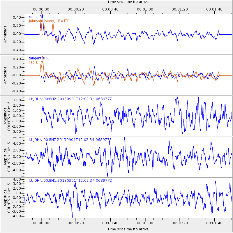
JOHN Johnston Island, USA - Earthquake Result Viewer
*The percent match for this event was below the threshold and hence no stack was calculated.
| Earthquake location: |
Banda Sea |
| Earthquake latitude/longitude: |
-7.4/128.2 |
| Earthquake time(UTC): |
2013/09/01 (244) 11:52:29 GMT |
| Earthquake Depth: |
112 km |
| Earthquake Magnitude: |
6.5 MWW, 6.4 MWC, 6.4 MWD, 6.5 MWW, 6.5 MWB, 6.5 MWC |
| Earthquake Catalog/Contributor: |
NEIC PDE/NEIC COMCAT |
|
| Network: |
IU Global Seismograph Network (GSN - IRIS/USGS) |
| Station: |
JOHN Johnston Island, USA |
| Lat/Lon: |
16.73 N/169.53 W |
| Elevation: |
2.0 m |
|
| Distance: |
66.1 deg |
| Az: |
68.084 deg |
| Baz: |
253.776 deg |
| Ray Param: |
$rayparam |
*The percent match for this event was below the threshold and hence was not used in the summary stack. |
|
| Radial Match: |
63.926933 % |
| Radial Bump: |
400 |
| Transverse Match: |
50.54817 % |
| Transverse Bump: |
400 |
| SOD ConfigId: |
626651 |
| Insert Time: |
2014-04-18 07:20:46.225 +0000 |
| GWidth: |
2.5 |
| Max Bumps: |
400 |
| Tol: |
0.001 |
|
Signal To Noise
| Channel | StoN | STA | LTA |
| IU:JOHN:00:BHZ:20130901T12:02:34.068977Z | 2.8095322 | 1.8693613E-6 | 6.653639E-7 |
| IU:JOHN:00:BH1:20130901T12:02:34.068977Z | 0.7287303 | 7.117966E-7 | 9.767627E-7 |
| IU:JOHN:00:BH2:20130901T12:02:34.068977Z | 1.090374 | 1.218268E-6 | 1.1172938E-6 |
| Arrivals |
| Ps | |
| PpPs | |
| PsPs/PpSs | |


