
GARM Garm, Tajikistan - Earthquake Result Viewer
| ||||||||||||||||||
| ||||||||||||||||||
| ||||||||||||||||||
|
Signal To Noise
| Channel | StoN | STA | LTA |
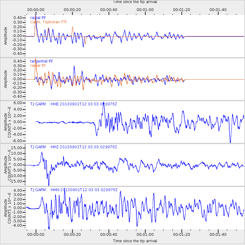
| TJ:GARM: :HHZ:20130901T12:03:03.029976Z | 32.99658 | 4.7713866E-6 | 1.4460245E-7 |
| TJ:GARM: :HHN:20130901T12:03:03.029976Z | 5.6058073 | 1.0656976E-6 | 1.9010598E-7 |
| TJ:GARM: :HHE:20130901T12:03:03.029976Z | 12.548477 | 1.7321784E-6 | 1.3803893E-7 |
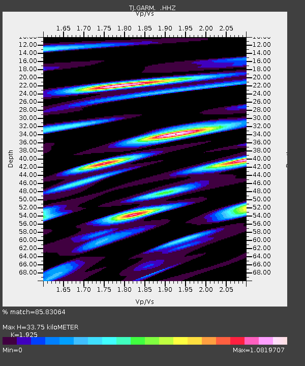
| Arrivals | |
| Ps | 5.1 SECOND |
| PpPs | 15 SECOND |
| PsPs/PpSs | 20 SECOND |

