You are here: Home > Network List > US - United States National Seismic Network Stations List
> Station EGMT Eagleton, Montana, USA > Earthquake Result Viewer
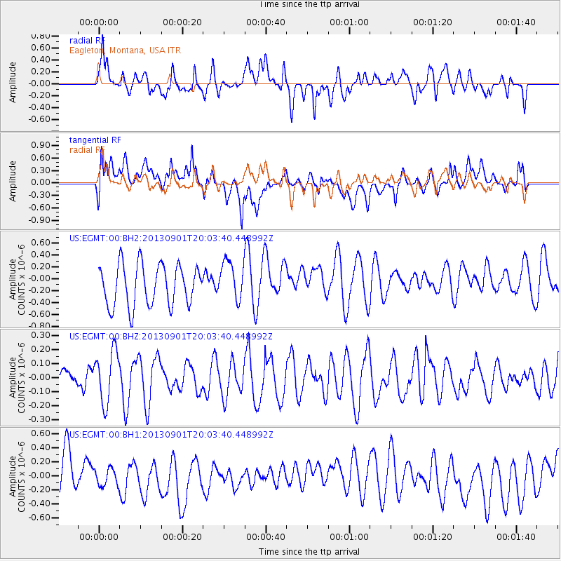
EGMT Eagleton, Montana, USA - Earthquake Result Viewer
*The percent match for this event was below the threshold and hence no stack was calculated.
| Earthquake location: |
Kermadec Islands Region |
| Earthquake latitude/longitude: |
-29.0/-176.4 |
| Earthquake time(UTC): |
2013/09/01 (244) 19:50:39 GMT |
| Earthquake Depth: |
10 km |
| Earthquake Magnitude: |
5.7 MWW, 5.7 MWB, 5.7 MWW, 5.8 MWC |
| Earthquake Catalog/Contributor: |
NEIC PDE/NEIC COMCAT |
|
| Network: |
US United States National Seismic Network |
| Station: |
EGMT Eagleton, Montana, USA |
| Lat/Lon: |
48.02 N/109.75 W |
| Elevation: |
1055 m |
|
| Distance: |
97.2 deg |
| Az: |
38.402 deg |
| Baz: |
234.128 deg |
| Ray Param: |
$rayparam |
*The percent match for this event was below the threshold and hence was not used in the summary stack. |
|
| Radial Match: |
68.79406 % |
| Radial Bump: |
400 |
| Transverse Match: |
64.125404 % |
| Transverse Bump: |
400 |
| SOD ConfigId: |
626651 |
| Insert Time: |
2014-04-18 07:35:37.267 +0000 |
| GWidth: |
2.5 |
| Max Bumps: |
400 |
| Tol: |
0.001 |
|
Signal To Noise
| Channel | StoN | STA | LTA |
| US:EGMT:00:BHZ:20130901T20:03:40.448992Z | 2.1045206 | 1.8830251E-7 | 8.947526E-8 |
| US:EGMT:00:BH1:20130901T20:03:40.448992Z | 0.6716296 | 1.655709E-7 | 2.4652113E-7 |
| US:EGMT:00:BH2:20130901T20:03:40.448992Z | 0.97313046 | 3.3902344E-7 | 3.4838436E-7 |
| Arrivals |
| Ps | |
| PpPs | |
| PsPs/PpSs | |


