You are here: Home > Network List > UW - Pacific Northwest Regional Seismic Network Stations List
> Station LEBA Lebam, WA, USA > Earthquake Result Viewer
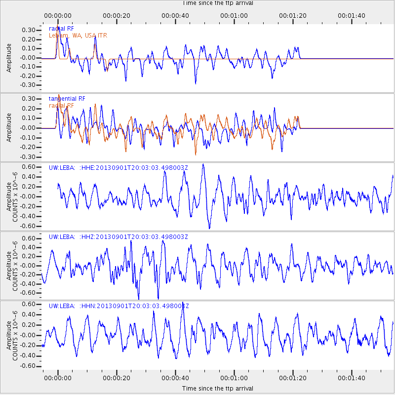
LEBA Lebam, WA, USA - Earthquake Result Viewer
*The percent match for this event was below the threshold and hence no stack was calculated.
| Earthquake location: |
Kermadec Islands Region |
| Earthquake latitude/longitude: |
-29.0/-176.4 |
| Earthquake time(UTC): |
2013/09/01 (244) 19:50:39 GMT |
| Earthquake Depth: |
10 km |
| Earthquake Magnitude: |
5.7 MWW, 5.7 MWB, 5.7 MWW, 5.8 MWC |
| Earthquake Catalog/Contributor: |
NEIC PDE/NEIC COMCAT |
|
| Network: |
UW Pacific Northwest Regional Seismic Network |
| Station: |
LEBA Lebam, WA, USA |
| Lat/Lon: |
46.55 N/123.56 W |
| Elevation: |
73 m |
|
| Distance: |
89.1 deg |
| Az: |
33.376 deg |
| Baz: |
224.266 deg |
| Ray Param: |
$rayparam |
*The percent match for this event was below the threshold and hence was not used in the summary stack. |
|
| Radial Match: |
48.73957 % |
| Radial Bump: |
400 |
| Transverse Match: |
50.259125 % |
| Transverse Bump: |
400 |
| SOD ConfigId: |
626651 |
| Insert Time: |
2014-04-18 07:36:39.074 +0000 |
| GWidth: |
2.5 |
| Max Bumps: |
400 |
| Tol: |
0.001 |
|
Signal To Noise
| Channel | StoN | STA | LTA |
| UW:LEBA: :HHZ:20130901T20:03:03.498003Z | 1.0948116 | 1.6924338E-7 | 1.5458676E-7 |
| UW:LEBA: :HHN:20130901T20:03:03.498003Z | 1.5251751 | 2.0872014E-7 | 1.3684995E-7 |
| UW:LEBA: :HHE:20130901T20:03:03.498003Z | 0.9421943 | 1.2741334E-7 | 1.3523042E-7 |
| Arrivals |
| Ps | |
| PpPs | |
| PsPs/PpSs | |


