You are here: Home > Network List > IU - Global Seismograph Network (GSN - IRIS/USGS) Stations List
> Station RSSD Black Hills, South Dakota, USA > Earthquake Result Viewer
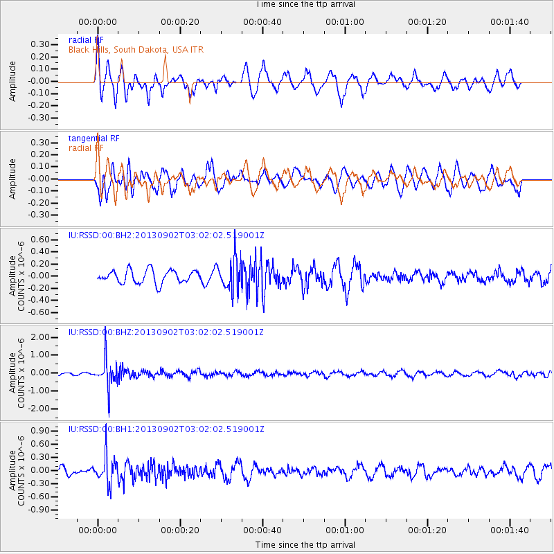
RSSD Black Hills, South Dakota, USA - Earthquake Result Viewer
*The percent match for this event was below the threshold and hence no stack was calculated.
| Earthquake location: |
Primor'ye, Russia |
| Earthquake latitude/longitude: |
42.2/133.7 |
| Earthquake time(UTC): |
2013/09/02 (245) 02:51:13 GMT |
| Earthquake Depth: |
445 km |
| Earthquake Magnitude: |
5.7 MWW, 5.7 MWW, 5.7 MWB, 5.7 MWC |
| Earthquake Catalog/Contributor: |
NEIC PDE/NEIC COMCAT |
|
| Network: |
IU Global Seismograph Network (GSN - IRIS/USGS) |
| Station: |
RSSD Black Hills, South Dakota, USA |
| Lat/Lon: |
44.12 N/104.04 W |
| Elevation: |
2090 m |
|
| Distance: |
79.7 deg |
| Az: |
38.22 deg |
| Baz: |
320.333 deg |
| Ray Param: |
$rayparam |
*The percent match for this event was below the threshold and hence was not used in the summary stack. |
|
| Radial Match: |
77.17874 % |
| Radial Bump: |
376 |
| Transverse Match: |
63.486618 % |
| Transverse Bump: |
400 |
| SOD ConfigId: |
626651 |
| Insert Time: |
2014-04-18 07:49:45.557 +0000 |
| GWidth: |
2.5 |
| Max Bumps: |
400 |
| Tol: |
0.001 |
|
Signal To Noise
| Channel | StoN | STA | LTA |
| IU:RSSD:00:BHZ:20130902T03:02:02.519001Z | 6.558881 | 8.0496824E-7 | 1.2272952E-7 |
| IU:RSSD:00:BH1:20130902T03:02:02.519001Z | 4.577011 | 3.1887333E-7 | 6.966846E-8 |
| IU:RSSD:00:BH2:20130902T03:02:02.519001Z | 2.4802518 | 2.652019E-7 | 1.0692539E-7 |
| Arrivals |
| Ps | |
| PpPs | |
| PsPs/PpSs | |


