You are here: Home > Network List > UW - Pacific Northwest Regional Seismic Network Stations List
> Station LEBA Lebam, WA, USA > Earthquake Result Viewer
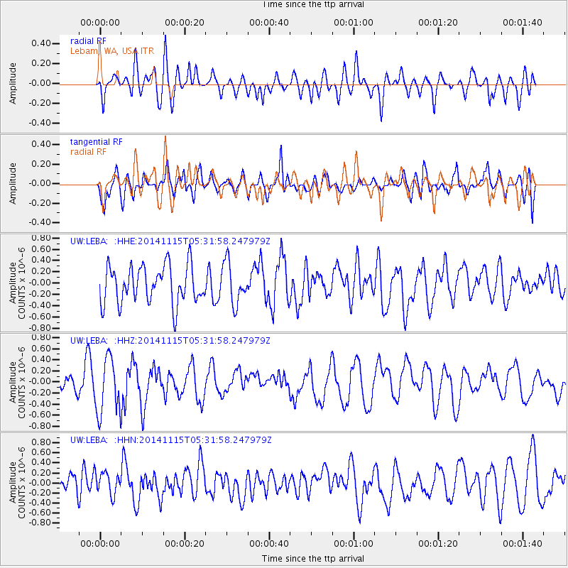
LEBA Lebam, WA, USA - Earthquake Result Viewer
*The percent match for this event was below the threshold and hence no stack was calculated.
| Earthquake location: |
Peru-Bolivia Border Region |
| Earthquake latitude/longitude: |
-17.3/-69.8 |
| Earthquake time(UTC): |
2014/11/15 (319) 05:20:37 GMT |
| Earthquake Depth: |
150 km |
| Earthquake Magnitude: |
5.0 mb, 5.0 mb |
| Earthquake Catalog/Contributor: |
ISC/ISC |
|
| Network: |
UW Pacific Northwest Regional Seismic Network |
| Station: |
LEBA Lebam, WA, USA |
| Lat/Lon: |
46.55 N/123.56 W |
| Elevation: |
73 m |
|
| Distance: |
79.8 deg |
| Az: |
325.569 deg |
| Baz: |
128.489 deg |
| Ray Param: |
$rayparam |
*The percent match for this event was below the threshold and hence was not used in the summary stack. |
|
| Radial Match: |
44.657665 % |
| Radial Bump: |
400 |
| Transverse Match: |
66.59256 % |
| Transverse Bump: |
400 |
| SOD ConfigId: |
3390531 |
| Insert Time: |
2019-04-15 00:34:39.800 +0000 |
| GWidth: |
2.5 |
| Max Bumps: |
400 |
| Tol: |
0.001 |
|
Signal To Noise
| Channel | StoN | STA | LTA |
| UW:LEBA: :HHZ:20141115T05:31:58.247979Z | 4.1743317 | 5.129123E-7 | 1.2287292E-7 |
| UW:LEBA: :HHN:20141115T05:31:58.247979Z | 0.6754588 | 2.1386737E-7 | 3.1662535E-7 |
| UW:LEBA: :HHE:20141115T05:31:58.247979Z | 1.1225518 | 3.7446185E-7 | 3.3358089E-7 |
| Arrivals |
| Ps | |
| PpPs | |
| PsPs/PpSs | |


