You are here: Home > Network List > US - United States National Seismic Network Stations List
> Station MIAR Mount Ida, Arkansas, USA > Earthquake Result Viewer
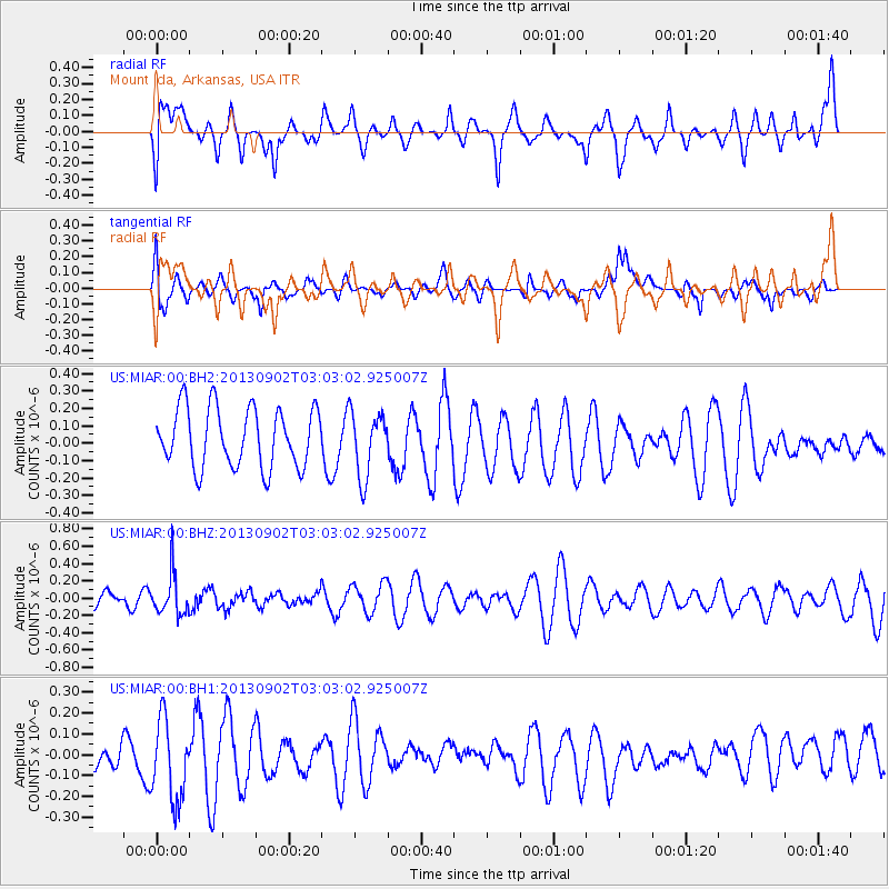
MIAR Mount Ida, Arkansas, USA - Earthquake Result Viewer
*The percent match for this event was below the threshold and hence no stack was calculated.
| Earthquake location: |
Primor'ye, Russia |
| Earthquake latitude/longitude: |
42.2/133.7 |
| Earthquake time(UTC): |
2013/09/02 (245) 02:51:13 GMT |
| Earthquake Depth: |
445 km |
| Earthquake Magnitude: |
5.7 MWW, 5.7 MWW, 5.7 MWB, 5.7 MWC |
| Earthquake Catalog/Contributor: |
NEIC PDE/NEIC COMCAT |
|
| Network: |
US United States National Seismic Network |
| Station: |
MIAR Mount Ida, Arkansas, USA |
| Lat/Lon: |
34.55 N/93.58 W |
| Elevation: |
207 m |
|
| Distance: |
92.2 deg |
| Az: |
37.338 deg |
| Baz: |
326.908 deg |
| Ray Param: |
$rayparam |
*The percent match for this event was below the threshold and hence was not used in the summary stack. |
|
| Radial Match: |
59.115463 % |
| Radial Bump: |
400 |
| Transverse Match: |
47.820835 % |
| Transverse Bump: |
400 |
| SOD ConfigId: |
626651 |
| Insert Time: |
2014-04-18 08:06:33.848 +0000 |
| GWidth: |
2.5 |
| Max Bumps: |
400 |
| Tol: |
0.001 |
|
Signal To Noise
| Channel | StoN | STA | LTA |
| US:MIAR:00:BHZ:20130902T03:03:02.925007Z | 3.5034847 | 2.373818E-7 | 6.775591E-8 |
| US:MIAR:00:BH1:20130902T03:03:02.925007Z | 1.9379581 | 2.0846103E-7 | 1.0756736E-7 |
| US:MIAR:00:BH2:20130902T03:03:02.925007Z | 1.1018612 | 1.8721279E-7 | 1.6990595E-7 |
| Arrivals |
| Ps | |
| PpPs | |
| PsPs/PpSs | |


