You are here: Home > Network List > US - United States National Seismic Network Stations List
> Station MSO Missoula, Montana, USA > Earthquake Result Viewer
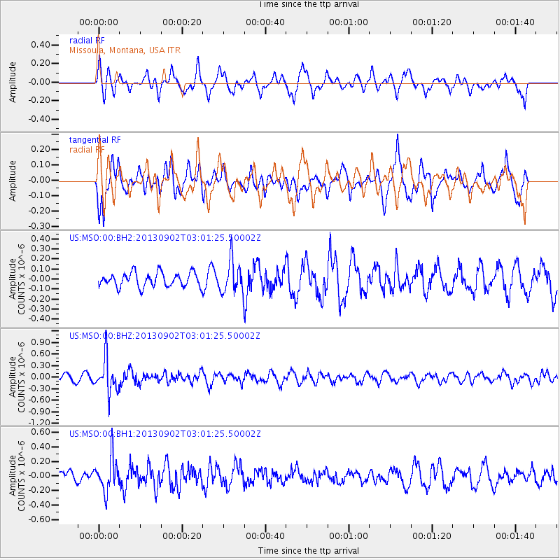
MSO Missoula, Montana, USA - Earthquake Result Viewer
*The percent match for this event was below the threshold and hence no stack was calculated.
| Earthquake location: |
Primor'ye, Russia |
| Earthquake latitude/longitude: |
42.2/133.7 |
| Earthquake time(UTC): |
2013/09/02 (245) 02:51:13 GMT |
| Earthquake Depth: |
445 km |
| Earthquake Magnitude: |
5.7 MWW, 5.7 MWW, 5.7 MWB, 5.7 MWC |
| Earthquake Catalog/Contributor: |
NEIC PDE/NEIC COMCAT |
|
| Network: |
US United States National Seismic Network |
| Station: |
MSO Missoula, Montana, USA |
| Lat/Lon: |
46.83 N/113.94 W |
| Elevation: |
1264 m |
|
| Distance: |
73.0 deg |
| Az: |
41.59 deg |
| Baz: |
314.08 deg |
| Ray Param: |
$rayparam |
*The percent match for this event was below the threshold and hence was not used in the summary stack. |
|
| Radial Match: |
63.42713 % |
| Radial Bump: |
384 |
| Transverse Match: |
65.129364 % |
| Transverse Bump: |
365 |
| SOD ConfigId: |
626651 |
| Insert Time: |
2014-04-18 08:06:35.814 +0000 |
| GWidth: |
2.5 |
| Max Bumps: |
400 |
| Tol: |
0.001 |
|
Signal To Noise
| Channel | StoN | STA | LTA |
| US:MSO:00:BHZ:20130902T03:01:25.50002Z | 6.8403063 | 4.4850168E-7 | 6.5567484E-8 |
| US:MSO:00:BH1:20130902T03:01:25.50002Z | 2.0610268 | 2.415992E-7 | 1.1722274E-7 |
| US:MSO:00:BH2:20130902T03:01:25.50002Z | 2.422918 | 1.6848784E-7 | 6.953922E-8 |
| Arrivals |
| Ps | |
| PpPs | |
| PsPs/PpSs | |


