You are here: Home > Network List > TA - USArray Transportable Network (new EarthScope stations) Stations List
> Station A21K Barrow, AK, USA > Earthquake Result Viewer
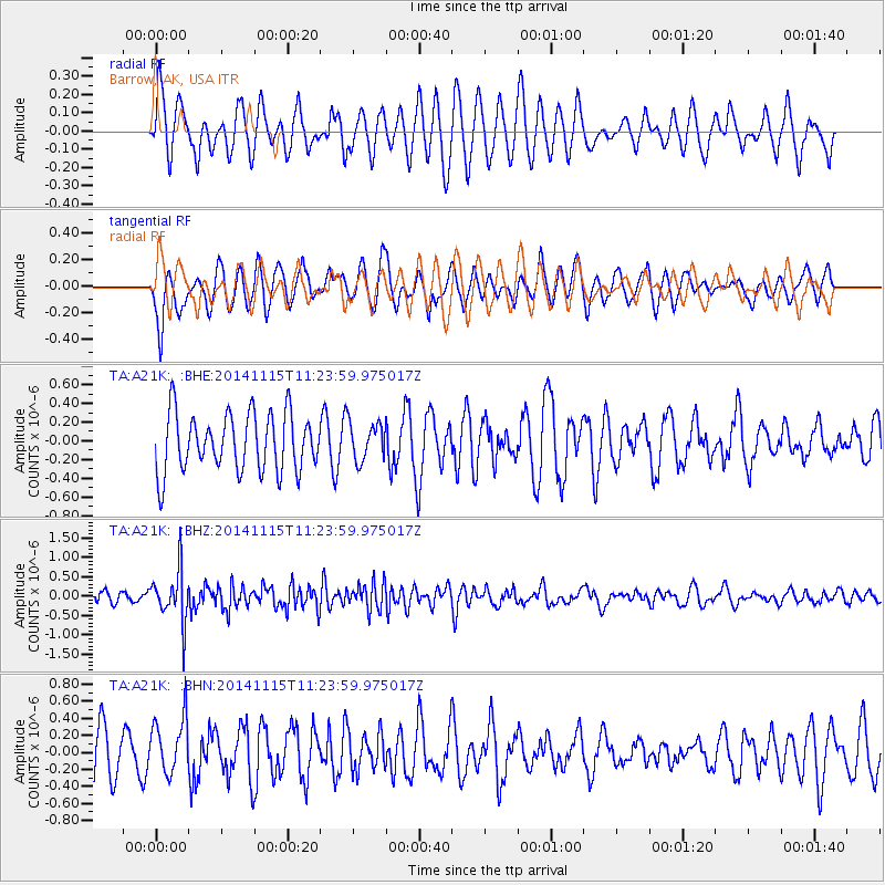
A21K Barrow, AK, USA - Earthquake Result Viewer
*The percent match for this event was below the threshold and hence no stack was calculated.
| Earthquake location: |
Northern Molucca Sea |
| Earthquake latitude/longitude: |
1.7/126.4 |
| Earthquake time(UTC): |
2014/11/15 (319) 11:12:04 GMT |
| Earthquake Depth: |
40 km |
| Earthquake Magnitude: |
5.5 MW, 5.4 mb, 4.7 MS |
| Earthquake Catalog/Contributor: |
ISC/ISC |
|
| Network: |
TA USArray Transportable Network (new EarthScope stations) |
| Station: |
A21K Barrow, AK, USA |
| Lat/Lon: |
71.32 N/156.62 W |
| Elevation: |
577 m |
|
| Distance: |
84.2 deg |
| Az: |
18.391 deg |
| Baz: |
258.183 deg |
| Ray Param: |
$rayparam |
*The percent match for this event was below the threshold and hence was not used in the summary stack. |
|
| Radial Match: |
64.809784 % |
| Radial Bump: |
400 |
| Transverse Match: |
66.70769 % |
| Transverse Bump: |
400 |
| SOD ConfigId: |
3390531 |
| Insert Time: |
2019-04-15 00:42:25.572 +0000 |
| GWidth: |
2.5 |
| Max Bumps: |
400 |
| Tol: |
0.001 |
|
Signal To Noise
| Channel | StoN | STA | LTA |
| TA:A21K: :BHZ:20141115T11:23:59.975017Z | 3.5598814 | 6.490045E-7 | 1.8231071E-7 |
| TA:A21K: :BHN:20141115T11:23:59.975017Z | 1.3042295 | 3.2638175E-7 | 2.502487E-7 |
| TA:A21K: :BHE:20141115T11:23:59.975017Z | 0.65841794 | 2.0407494E-7 | 3.099474E-7 |
| Arrivals |
| Ps | |
| PpPs | |
| PsPs/PpSs | |


