You are here: Home > Network List > TA - USArray Transportable Network (new EarthScope stations) Stations List
> Station POKR Poker Plat Research Range, AK, USA > Earthquake Result Viewer
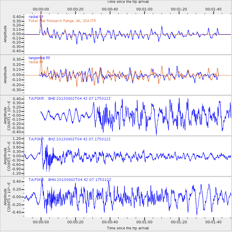
POKR Poker Plat Research Range, AK, USA - Earthquake Result Viewer
*The percent match for this event was below the threshold and hence no stack was calculated.
| Earthquake location: |
Solomon Islands |
| Earthquake latitude/longitude: |
-6.6/155.1 |
| Earthquake time(UTC): |
2013/09/02 (245) 04:30:16 GMT |
| Earthquake Depth: |
35 km |
| Earthquake Magnitude: |
5.9 MWW, 5.8 MWB, 6.0 MWC |
| Earthquake Catalog/Contributor: |
NEIC PDE/NEIC COMCAT |
|
| Network: |
TA USArray Transportable Network (new EarthScope stations) |
| Station: |
POKR Poker Plat Research Range, AK, USA |
| Lat/Lon: |
65.12 N/147.43 W |
| Elevation: |
501 m |
|
| Distance: |
83.0 deg |
| Az: |
21.055 deg |
| Baz: |
237.515 deg |
| Ray Param: |
$rayparam |
*The percent match for this event was below the threshold and hence was not used in the summary stack. |
|
| Radial Match: |
64.43083 % |
| Radial Bump: |
400 |
| Transverse Match: |
49.366177 % |
| Transverse Bump: |
390 |
| SOD ConfigId: |
626651 |
| Insert Time: |
2014-04-18 08:23:03.144 +0000 |
| GWidth: |
2.5 |
| Max Bumps: |
400 |
| Tol: |
0.001 |
|
Signal To Noise
| Channel | StoN | STA | LTA |
| TA:POKR: :BHZ:20130902T04:42:07.175012Z | 5.4859667 | 5.7468486E-7 | 1.04755436E-7 |
| TA:POKR: :BHN:20130902T04:42:07.175012Z | 3.2699578 | 2.0801126E-7 | 6.361282E-8 |
| TA:POKR: :BHE:20130902T04:42:07.175012Z | 1.9096446 | 1.502019E-7 | 7.8654374E-8 |
| Arrivals |
| Ps | |
| PpPs | |
| PsPs/PpSs | |


