You are here: Home > Network List > UU - University of Utah Regional Network Stations List
> Station KNB Kanab, UT, USA > Earthquake Result Viewer
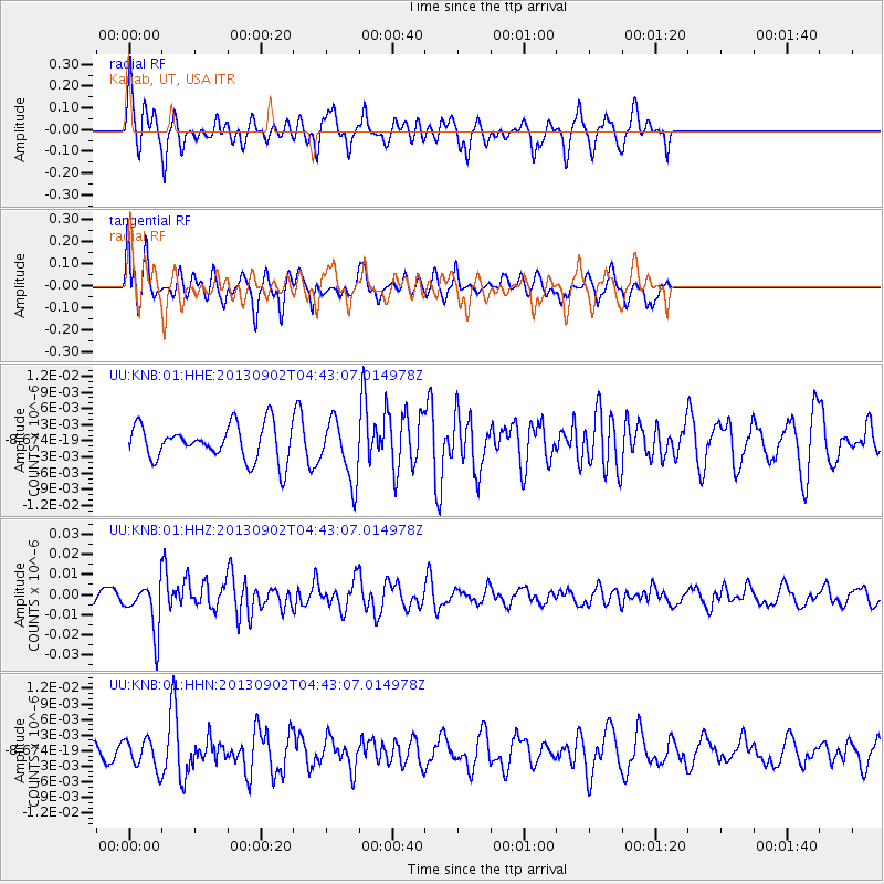
KNB Kanab, UT, USA - Earthquake Result Viewer
*The percent match for this event was below the threshold and hence no stack was calculated.
| Earthquake location: |
Solomon Islands |
| Earthquake latitude/longitude: |
-6.6/155.1 |
| Earthquake time(UTC): |
2013/09/02 (245) 04:30:16 GMT |
| Earthquake Depth: |
35 km |
| Earthquake Magnitude: |
5.9 MWW, 5.8 MWB, 6.0 MWC |
| Earthquake Catalog/Contributor: |
NEIC PDE/NEIC COMCAT |
|
| Network: |
UU University of Utah Regional Network |
| Station: |
KNB Kanab, UT, USA |
| Lat/Lon: |
37.02 N/112.82 W |
| Elevation: |
1715 m |
|
| Distance: |
95.6 deg |
| Az: |
53.484 deg |
| Baz: |
265.936 deg |
| Ray Param: |
$rayparam |
*The percent match for this event was below the threshold and hence was not used in the summary stack. |
|
| Radial Match: |
58.209328 % |
| Radial Bump: |
368 |
| Transverse Match: |
58.799942 % |
| Transverse Bump: |
400 |
| SOD ConfigId: |
626651 |
| Insert Time: |
2014-04-18 08:24:26.140 +0000 |
| GWidth: |
2.5 |
| Max Bumps: |
400 |
| Tol: |
0.001 |
|
Signal To Noise
| Channel | StoN | STA | LTA |
| UU:KNB:01:HHZ:20130902T04:43:07.014978Z | 3.924467 | 1.1949029E-8 | 3.044752E-9 |
| UU:KNB:01:HHN:20130902T04:43:07.014978Z | 0.97258925 | 2.7909712E-9 | 2.8696299E-9 |
| UU:KNB:01:HHE:20130902T04:43:07.014978Z | 1.6881244 | 5.5428995E-9 | 3.283466E-9 |
| Arrivals |
| Ps | |
| PpPs | |
| PsPs/PpSs | |


