
HEH Heihe,Heilongjiang Province - Earthquake Result Viewer
| ||||||||||||||||||
| ||||||||||||||||||
| ||||||||||||||||||
|
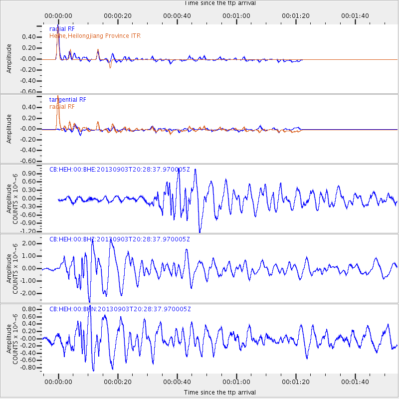
Signal To Noise
| Channel | StoN | STA | LTA |
| CB:HEH:00:BHZ:20130903T20:28:37.970005Z | 3.9449363 | 4.4383302E-7 | 1.1250702E-7 |
| CB:HEH:00:BHN:20130903T20:28:37.970005Z | 3.3433037 | 2.004144E-7 | 5.994502E-8 |
| CB:HEH:00:BHE:20130903T20:28:37.970005Z | 2.4818873 | 1.7059529E-7 | 6.8736114E-8 |
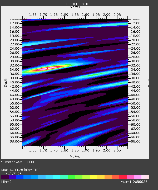
| Arrivals | |
| Ps | 3.9 SECOND |
| PpPs | 13 SECOND |
| PsPs/PpSs | 17 SECOND |

