TEIG Tepich, Yucatan, Mexico - Earthquake Result Viewer
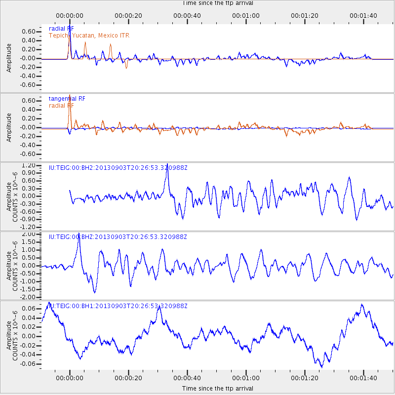
Earthquake location: Queen Charlotte Islands Region
Earthquake latitude/longitude: 51.2/-130.4
Earthquake time(UTC): 2013/09/03 (246) 20:19:06 GMT
Earthquake Depth: 2.7 km
Earthquake Magnitude: 6.1 MWW, 6.0 MWB, 6.1 MWW, 6.1 MWC, 6.2 MI, 6.2 MWC
Earthquake Catalog/Contributor: NEIC PDE/NEIC COMCAT
Network: IU Global Seismograph Network (GSN - IRIS/USGS)
Station: TEIG Tepich, Yucatan, Mexico
Lat/Lon: 20.23 N/88.28 W
Elevation: 40 m
Distance: 45.2 deg
Az: 117.346 deg
Baz: 323.52 deg
Ray Param: 0.07148149
Estimated Moho Depth: 24.5 km
Estimated Crust Vp/Vs: 1.83
Assumed Crust Vp: 5.817 km/s
Estimated Crust Vs: 3.187 km/s
Estimated Crust Poisson's Ratio: 0.29
Radial Match: 83.535355 %
Radial Bump: 400
Transverse Match: 70.99367 %
Transverse Bump: 400
SOD ConfigId: 626651
Insert Time: 2014-04-18 08:32:33.957 +0000
GWidth: 2.5
Max Bumps: 400
Tol: 0.001

Signal To Noise

ChannelStoNSTALTA
IU:TEIG:00:BHZ:20130903T20:26:53.320988Z8.6333837.918835E-79.1723436E-8
IU:TEIG:00:BH1:20130903T20:26:53.320988Z0.559797172.3228534E-84.1494555E-8
IU:TEIG:00:BH2:20130903T20:26:53.320988Z5.0919884.813409E-79.452907E-8
Arrivals
Ps3.7 SECOND
PpPs11 SECOND
PsPs/PpSs15 SECOND