060Z West Palm Beach, FL, USA - Earthquake Result Viewer
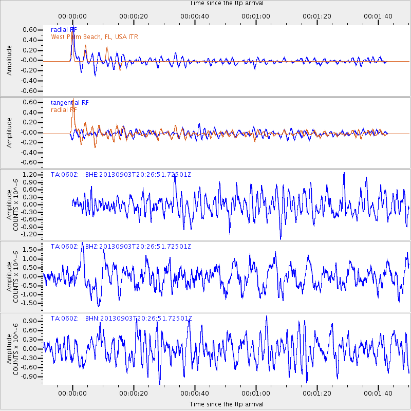
Earthquake location: Queen Charlotte Islands Region
Earthquake latitude/longitude: 51.2/-130.4
Earthquake time(UTC): 2013/09/03 (246) 20:19:06 GMT
Earthquake Depth: 2.7 km
Earthquake Magnitude: 6.1 MWW, 6.0 MWB, 6.1 MWW, 6.1 MWC, 6.2 MI, 6.2 MWC
Earthquake Catalog/Contributor: NEIC PDE/NEIC COMCAT
Network: TA USArray Transportable Network (new EarthScope stations)
Station: 060Z West Palm Beach, FL, USA
Lat/Lon: 26.41 N/80.56 W
Elevation: 9.0 m
Distance: 45.0 deg
Az: 104.072 deg
Baz: 317.17 deg
Ray Param: 0.071612634
Estimated Moho Depth: 14.0 km
Estimated Crust Vp/Vs: 1.81
Assumed Crust Vp: 6.347 km/s
Estimated Crust Vs: 3.512 km/s
Estimated Crust Poisson's Ratio: 0.28
Radial Match: 80.56729 %
Radial Bump: 400
Transverse Match: 55.227093 %
Transverse Bump: 400
SOD ConfigId: 626651
Insert Time: 2014-04-18 08:38:10.009 +0000
GWidth: 2.5
Max Bumps: 400
Tol: 0.001

Signal To Noise

ChannelStoNSTALTA
TA:060Z: :BHZ:20130903T20:26:51.72501Z3.10847437.9142205E-72.5460145E-7
TA:060Z: :BHN:20130903T20:26:51.72501Z1.32721823.470098E-72.6145648E-7
TA:060Z: :BHE:20130903T20:26:51.72501Z1.71040634.2486292E-72.4839883E-7
Arrivals
Ps1.9 SECOND
PpPs5.8 SECOND
PsPs/PpSs7.7 SECOND