
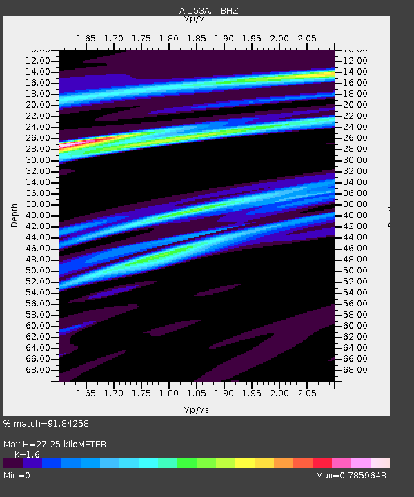
153A Fort Valley, GA, USA - Earthquake Result Viewer
| ||||||||||||||||||
| ||||||||||||||||||
| ||||||||||||||||||
|
Signal To Noise
| Channel | StoN | STA | LTA |
| TA:153A: :BHZ:20130903T20:25:59.248997Z | 3.785482 | 6.333831E-7 | 1.67319E-7 |
| TA:153A: :BHN:20130903T20:25:59.248997Z | 1.192261 | 2.712501E-7 | 2.2750899E-7 |
| TA:153A: :BHE:20130903T20:25:59.248997Z | 1.9223546 | 3.845262E-7 | 2.0002877E-7 |
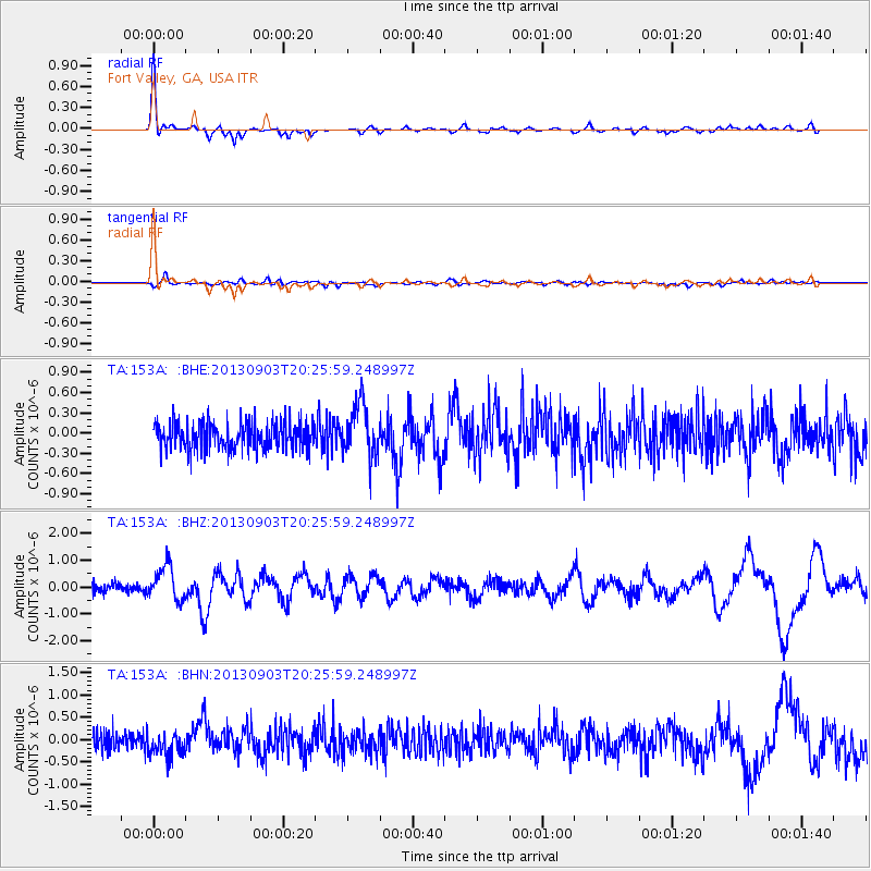
| Arrivals | |
| Ps | 2.7 SECOND |
| PpPs | 9.9 SECOND |
| PsPs/PpSs | 13 SECOND |

