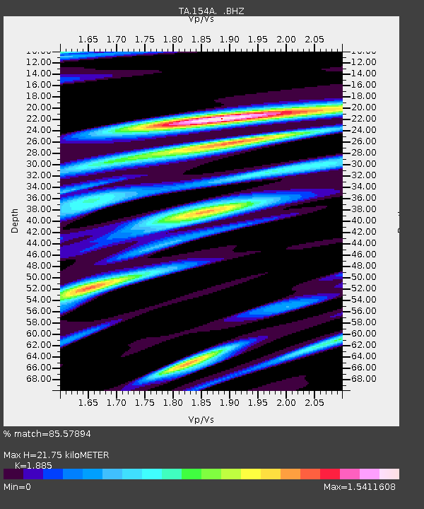
154A Montrose, GA, USA - Earthquake Result Viewer
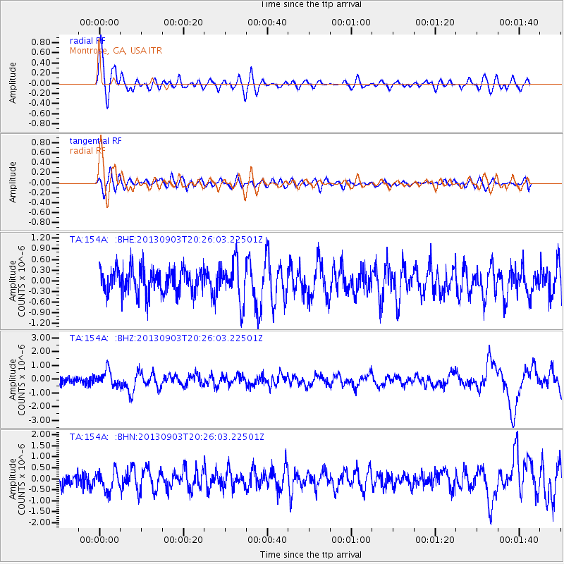
Earthquake location: Queen Charlotte Islands Region
Earthquake latitude/longitude: 51.2/-130.4
Earthquake time(UTC): 2013/09/03 (246) 20:19:06 GMT
Earthquake Depth: 2.7 km
Earthquake Magnitude: 6.1 MWW, 6.0 MWB, 6.1 MWW, 6.1 MWC, 6.2 MI, 6.2 MWC
Earthquake Catalog/Contributor: NEIC PDE/NEIC COMCAT
Network: TA USArray Transportable Network (new EarthScope stations)
Station: 154A Montrose, GA, USA
Lat/Lon: 32.61 N/83.11 W
Elevation: 111 m
Distance: 39.0 deg
Az: 99.885 deg
Baz: 312.801 deg
Ray Param: 0.075248286
Estimated Moho Depth: 21.75 km
Estimated Crust Vp/Vs: 1.88
Assumed Crust Vp: 6.565 km/s
Estimated Crust Vs: 3.483 km/s
Estimated Crust Poisson's Ratio: 0.30
Radial Match: 85.57894 %
Radial Bump: 400
Transverse Match: 57.273846 %
Transverse Bump: 400
SOD ConfigId: 626651
Insert Time: 2014-04-18 08:38:21.530 +0000
GWidth: 2.5
Max Bumps: 400
Tol: 0.001

Signal To Noise

ChannelStoNSTALTA
TA:154A: :BHZ:20130903T20:26:03.22501Z2.749745.650186E-72.0548075E-7
TA:154A: :BHN:20130903T20:26:03.22501Z1.37371154.6155373E-73.359903E-7
TA:154A: :BHE:20130903T20:26:03.22501Z1.64608815.7259456E-73.478517E-7
Arrivals
Ps3.1 SECOND
PpPs8.9 SECOND
PsPs/PpSs12 SECOND