254A Abbeville, GA, USA - Earthquake Result Viewer
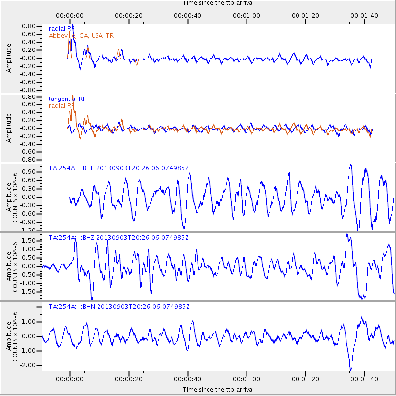
Earthquake location: Queen Charlotte Islands Region
Earthquake latitude/longitude: 51.2/-130.4
Earthquake time(UTC): 2013/09/03 (246) 20:19:06 GMT
Earthquake Depth: 2.7 km
Earthquake Magnitude: 6.1 MWW, 6.0 MWB, 6.1 MWW, 6.1 MWC, 6.2 MI, 6.2 MWC
Earthquake Catalog/Contributor: NEIC PDE/NEIC COMCAT
Network: TA USArray Transportable Network (new EarthScope stations)
Station: 254A Abbeville, GA, USA
Lat/Lon: 31.95 N/83.29 W
Elevation: 78 m
Distance: 39.4 deg
Az: 100.823 deg
Baz: 313.43 deg
Ray Param: 0.07505119
Estimated Moho Depth: 18.75 km
Estimated Crust Vp/Vs: 1.60
Assumed Crust Vp: 6.565 km/s
Estimated Crust Vs: 4.103 km/s
Estimated Crust Poisson's Ratio: 0.18
Radial Match: 84.8125 %
Radial Bump: 285
Transverse Match: 55.128548 %
Transverse Bump: 360
SOD ConfigId: 626651
Insert Time: 2014-04-18 08:38:38.210 +0000
GWidth: 2.5
Max Bumps: 400
Tol: 0.001

Signal To Noise

ChannelStoNSTALTA
TA:254A: :BHZ:20130903T20:26:06.074985Z6.5158626.652588E-71.0209836E-7
TA:254A: :BHN:20130903T20:26:06.074985Z1.39481274.823442E-73.458129E-7
TA:254A: :BHE:20130903T20:26:06.074985Z0.817081332.8956785E-73.543929E-7
Arrivals
Ps1.9 SECOND
PpPs6.8 SECOND
PsPs/PpSs8.7 SECOND