256A Glennville, GA, USA - Earthquake Result Viewer
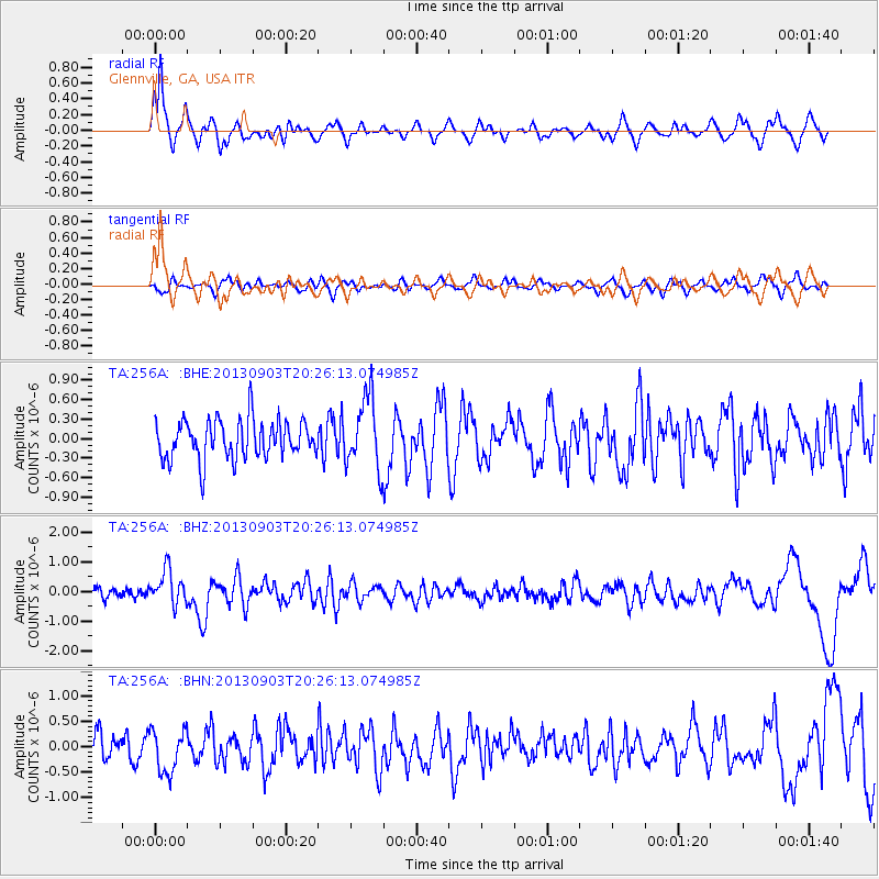
Earthquake location: Queen Charlotte Islands Region
Earthquake latitude/longitude: 51.2/-130.4
Earthquake time(UTC): 2013/09/03 (246) 20:19:06 GMT
Earthquake Depth: 2.7 km
Earthquake Magnitude: 6.1 MWW, 6.0 MWB, 6.1 MWW, 6.1 MWC, 6.2 MI, 6.2 MWC
Earthquake Catalog/Contributor: NEIC PDE/NEIC COMCAT
Network: TA USArray Transportable Network (new EarthScope stations)
Station: 256A Glennville, GA, USA
Lat/Lon: 31.98 N/81.89 W
Elevation: 46 m
Distance: 40.2 deg
Az: 99.506 deg
Baz: 313.157 deg
Ray Param: 0.07454784
Estimated Moho Depth: 10.5 km
Estimated Crust Vp/Vs: 1.99
Assumed Crust Vp: 5.989 km/s
Estimated Crust Vs: 3.01 km/s
Estimated Crust Poisson's Ratio: 0.33
Radial Match: 81.89359 %
Radial Bump: 400
Transverse Match: 43.52879 %
Transverse Bump: 400
SOD ConfigId: 626651
Insert Time: 2014-04-18 08:38:43.607 +0000
GWidth: 2.5
Max Bumps: 400
Tol: 0.001

Signal To Noise

ChannelStoNSTALTA
TA:256A: :BHZ:20130903T20:26:13.074985Z4.0751625.839727E-71.433005E-7
TA:256A: :BHN:20130903T20:26:13.074985Z1.87501384.2426282E-72.2627182E-7
TA:256A: :BHE:20130903T20:26:13.074985Z1.82507255.454016E-72.9883827E-7
Arrivals
Ps1.8 SECOND
PpPs5.0 SECOND
PsPs/PpSs6.8 SECOND