
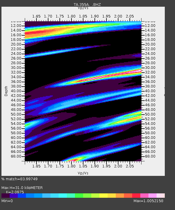
355A Pearson, GA, USA - Earthquake Result Viewer
| ||||||||||||||||||
| ||||||||||||||||||
| ||||||||||||||||||
|
Signal To Noise
| Channel | StoN | STA | LTA |
| TA:355A: :BHZ:20130903T20:26:11.774998Z | 4.2435493 | 5.6972266E-7 | 1.3425615E-7 |
| TA:355A: :BHN:20130903T20:26:11.774998Z | 1.1047949 | 2.7946345E-7 | 2.5295503E-7 |
| TA:355A: :BHE:20130903T20:26:11.774998Z | 2.0611777 | 4.0284604E-7 | 1.9544458E-7 |
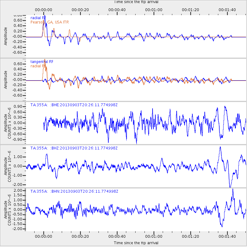
| Arrivals | |
| Ps | 5.5 SECOND |
| PpPs | 14 SECOND |
| PsPs/PpSs | 19 SECOND |

