435B Jarrell, TX, USA - Earthquake Result Viewer
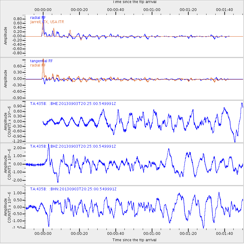
Earthquake location: Queen Charlotte Islands Region
Earthquake latitude/longitude: 51.2/-130.4
Earthquake time(UTC): 2013/09/03 (246) 20:19:06 GMT
Earthquake Depth: 2.7 km
Earthquake Magnitude: 6.1 MWW, 6.0 MWB, 6.1 MWW, 6.1 MWC, 6.2 MI, 6.2 MWC
Earthquake Catalog/Contributor: NEIC PDE/NEIC COMCAT
Network: TA USArray Transportable Network (new EarthScope stations)
Station: 435B Jarrell, TX, USA
Lat/Lon: 30.78 N/97.58 W
Elevation: 248 m
Distance: 31.7 deg
Az: 117.471 deg
Baz: 319.608 deg
Ray Param: 0.07897564
Estimated Moho Depth: 14.25 km
Estimated Crust Vp/Vs: 1.62
Assumed Crust Vp: 6.347 km/s
Estimated Crust Vs: 3.924 km/s
Estimated Crust Poisson's Ratio: 0.19
Radial Match: 86.73886 %
Radial Bump: 354
Transverse Match: 69.16391 %
Transverse Bump: 400
SOD ConfigId: 626651
Insert Time: 2014-04-18 08:39:00.833 +0000
GWidth: 2.5
Max Bumps: 400
Tol: 0.001

Signal To Noise

ChannelStoNSTALTA
TA:435B: :BHZ:20130903T20:25:00.549991Z8.6744779.1441547E-71.05414486E-7
TA:435B: :BHN:20130903T20:25:00.549991Z4.822465.387634E-71.11719615E-7
TA:435B: :BHE:20130903T20:25:00.549991Z2.8309144.128044E-71.458202E-7
Arrivals
Ps1.5 SECOND
PpPs5.4 SECOND
PsPs/PpSs6.9 SECOND