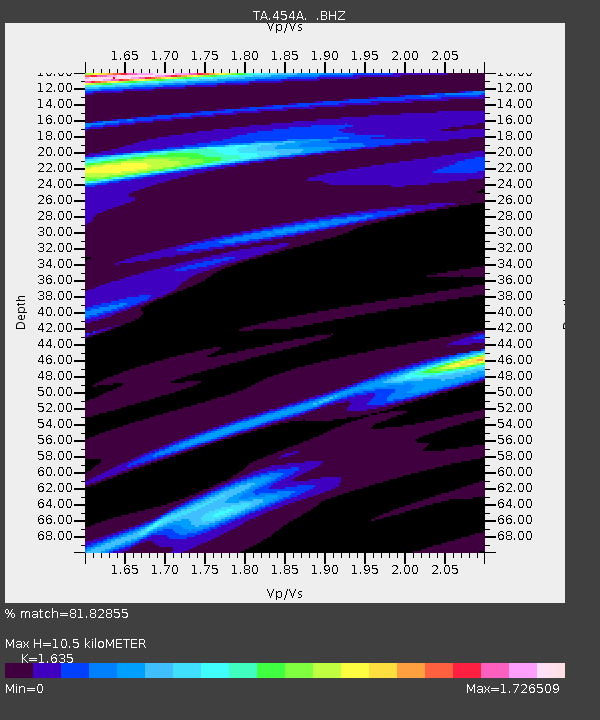
454A Quitman, GA, USA - Earthquake Result Viewer
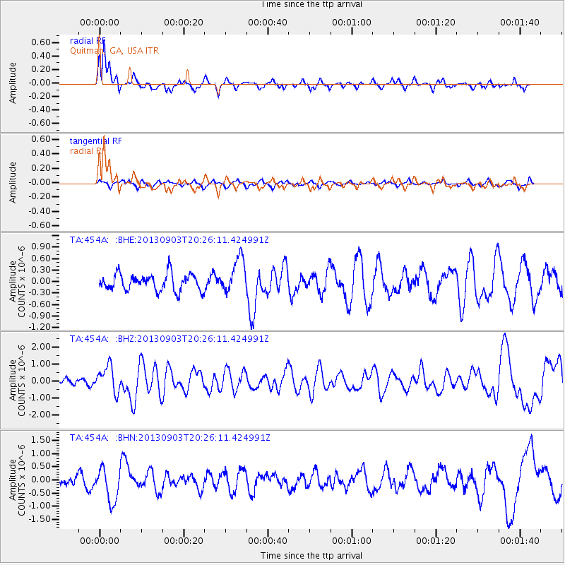
Earthquake location: Queen Charlotte Islands Region
Earthquake latitude/longitude: 51.2/-130.4
Earthquake time(UTC): 2013/09/03 (246) 20:19:06 GMT
Earthquake Depth: 2.7 km
Earthquake Magnitude: 6.1 MWW, 6.0 MWB, 6.1 MWW, 6.1 MWC, 6.2 MI, 6.2 MWC
Earthquake Catalog/Contributor: NEIC PDE/NEIC COMCAT
Network: TA USArray Transportable Network (new EarthScope stations)
Station: 454A Quitman, GA, USA
Lat/Lon: 30.71 N/83.63 W
Elevation: 50 m
Distance: 40.0 deg
Az: 102.522 deg
Baz: 314.563 deg
Ray Param: 0.07467145
Estimated Moho Depth: 10.5 km
Estimated Crust Vp/Vs: 1.63
Assumed Crust Vp: 6.565 km/s
Estimated Crust Vs: 4.015 km/s
Estimated Crust Poisson's Ratio: 0.20
Radial Match: 81.82855 %
Radial Bump: 333
Transverse Match: 64.33692 %
Transverse Bump: 400
SOD ConfigId: 626651
Insert Time: 2014-04-18 08:39:08.025 +0000
GWidth: 2.5
Max Bumps: 400
Tol: 0.001

Signal To Noise

ChannelStoNSTALTA
TA:454A: :BHZ:20130903T20:26:11.424991Z4.379167.9418766E-71.8135617E-7
TA:454A: :BHN:20130903T20:26:11.424991Z4.212976.3643165E-71.5106485E-7
TA:454A: :BHE:20130903T20:26:11.424991Z2.13803324.6686978E-72.1836415E-7
Arrivals
Ps1.1 SECOND
PpPs3.9 SECOND
PsPs/PpSs5.0 SECOND