456A Hilliard, FL, USA - Earthquake Result Viewer
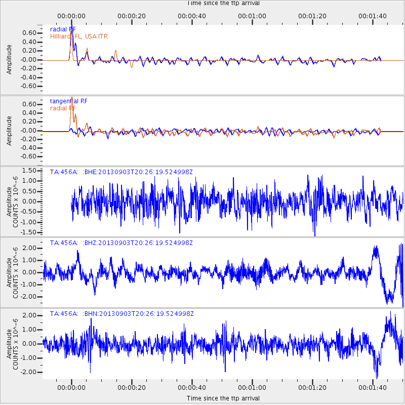
Earthquake location: Queen Charlotte Islands Region
Earthquake latitude/longitude: 51.2/-130.4
Earthquake time(UTC): 2013/09/03 (246) 20:19:06 GMT
Earthquake Depth: 2.7 km
Earthquake Magnitude: 6.1 MWW, 6.0 MWB, 6.1 MWW, 6.1 MWC, 6.2 MI, 6.2 MWC
Earthquake Catalog/Contributor: NEIC PDE/NEIC COMCAT
Network: TA USArray Transportable Network (new EarthScope stations)
Station: 456A Hilliard, FL, USA
Lat/Lon: 30.72 N/82.02 W
Elevation: 26 m
Distance: 41.0 deg
Az: 101.019 deg
Baz: 314.236 deg
Ray Param: 0.07409706
Estimated Moho Depth: 32.0 km
Estimated Crust Vp/Vs: 1.97
Assumed Crust Vp: 6.565 km/s
Estimated Crust Vs: 3.332 km/s
Estimated Crust Poisson's Ratio: 0.33
Radial Match: 88.69493 %
Radial Bump: 400
Transverse Match: 43.151737 %
Transverse Bump: 400
SOD ConfigId: 626651
Insert Time: 2014-04-18 08:39:12.700 +0000
GWidth: 2.5
Max Bumps: 400
Tol: 0.001

Signal To Noise

ChannelStoNSTALTA
TA:456A: :BHZ:20130903T20:26:19.524998Z2.0293136.6162573E-73.2603432E-7
TA:456A: :BHN:20130903T20:26:19.524998Z1.37247844.9421794E-73.6009158E-7
TA:456A: :BHE:20130903T20:26:19.524998Z1.07941514.590871E-74.25311E-7
Arrivals
Ps5.0 SECOND
PpPs14 SECOND
PsPs/PpSs19 SECOND