D51A Lot 18 Range III Mazenod Township, QC, CAN - Earthquake Result Viewer
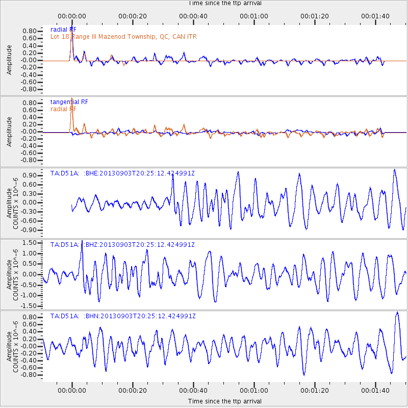
Earthquake location: Queen Charlotte Islands Region
Earthquake latitude/longitude: 51.2/-130.4
Earthquake time(UTC): 2013/09/03 (246) 20:19:06 GMT
Earthquake Depth: 2.7 km
Earthquake Magnitude: 6.1 MWW, 6.0 MWB, 6.1 MWW, 6.1 MWC, 6.2 MI, 6.2 MWC
Earthquake Catalog/Contributor: NEIC PDE/NEIC COMCAT
Network: TA USArray Transportable Network (new EarthScope stations)
Station: D51A Lot 18 Range III Mazenod Township, QC, CAN
Lat/Lon: 47.09 N/79.37 W
Elevation: 282 m
Distance: 33.1 deg
Az: 76.792 deg
Baz: 296.419 deg
Ray Param: 0.0783944
Estimated Moho Depth: 36.0 km
Estimated Crust Vp/Vs: 1.67
Assumed Crust Vp: 6.622 km/s
Estimated Crust Vs: 3.959 km/s
Estimated Crust Poisson's Ratio: 0.22
Radial Match: 88.98957 %
Radial Bump: 294
Transverse Match: 39.802357 %
Transverse Bump: 400
SOD ConfigId: 626651
Insert Time: 2014-04-18 08:39:35.522 +0000
GWidth: 2.5
Max Bumps: 400
Tol: 0.001

Signal To Noise

ChannelStoNSTALTA
TA:D51A: :BHZ:20130903T20:25:12.424991Z3.34022975.678029E-71.6998918E-7
TA:D51A: :BHN:20130903T20:25:12.424991Z1.23885081.7416527E-71.4058615E-7
TA:D51A: :BHE:20130903T20:25:12.424991Z2.6712653.2147167E-71.2034437E-7
Arrivals
Ps4.0 SECOND
PpPs13 SECOND
PsPs/PpSs17 SECOND