F49A Sandfield, ON, CAN - Earthquake Result Viewer
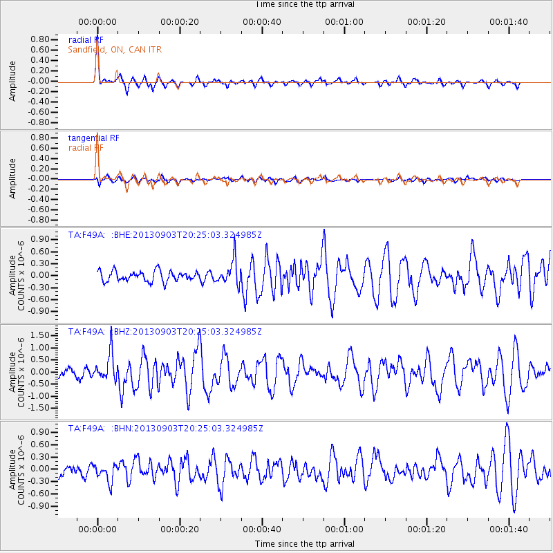
Earthquake location: Queen Charlotte Islands Region
Earthquake latitude/longitude: 51.2/-130.4
Earthquake time(UTC): 2013/09/03 (246) 20:19:06 GMT
Earthquake Depth: 2.7 km
Earthquake Magnitude: 6.1 MWW, 6.0 MWB, 6.1 MWW, 6.1 MWC, 6.2 MI, 6.2 MWC
Earthquake Catalog/Contributor: NEIC PDE/NEIC COMCAT
Network: TA USArray Transportable Network (new EarthScope stations)
Station: F49A Sandfield, ON, CAN
Lat/Lon: 45.76 N/82.04 W
Elevation: 230 m
Distance: 32.0 deg
Az: 80.551 deg
Baz: 297.66 deg
Ray Param: 0.078841105
Estimated Moho Depth: 14.5 km
Estimated Crust Vp/Vs: 1.72
Assumed Crust Vp: 6.483 km/s
Estimated Crust Vs: 3.769 km/s
Estimated Crust Poisson's Ratio: 0.24
Radial Match: 88.71471 %
Radial Bump: 320
Transverse Match: 57.442856 %
Transverse Bump: 400
SOD ConfigId: 626651
Insert Time: 2014-04-18 08:40:12.307 +0000
GWidth: 2.5
Max Bumps: 400
Tol: 0.001

Signal To Noise

ChannelStoNSTALTA
TA:F49A: :BHZ:20130903T20:25:03.324985Z3.1934165.8995244E-71.8474023E-7
TA:F49A: :BHN:20130903T20:25:03.324985Z1.8448352.164322E-71.1731792E-7
TA:F49A: :BHE:20130903T20:25:03.324985Z2.54157193.230377E-71.2710156E-7
Arrivals
Ps1.8 SECOND
PpPs5.6 SECOND
PsPs/PpSs7.3 SECOND