G45A Suttons Bay, MI, USA - Earthquake Result Viewer
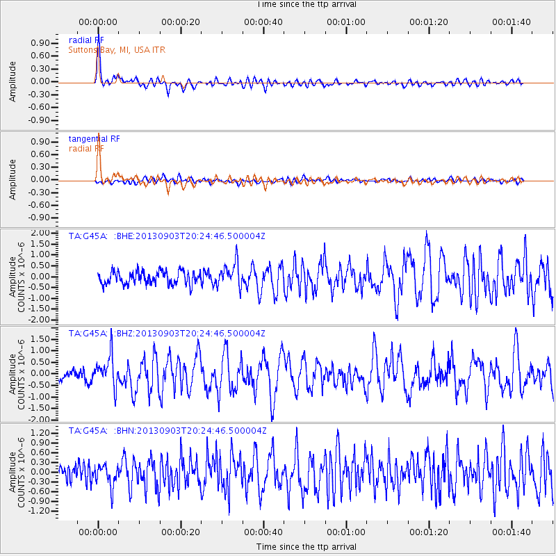
Earthquake location: Queen Charlotte Islands Region
Earthquake latitude/longitude: 51.2/-130.4
Earthquake time(UTC): 2013/09/03 (246) 20:19:06 GMT
Earthquake Depth: 2.7 km
Earthquake Magnitude: 6.1 MWW, 6.0 MWB, 6.1 MWW, 6.1 MWC, 6.2 MI, 6.2 MWC
Earthquake Catalog/Contributor: NEIC PDE/NEIC COMCAT
Network: TA USArray Transportable Network (new EarthScope stations)
Station: G45A Suttons Bay, MI, USA
Lat/Lon: 45.04 N/85.66 W
Elevation: 284 m
Distance: 30.1 deg
Az: 84.096 deg
Baz: 298.131 deg
Ray Param: 0.079426445
Estimated Moho Depth: 33.5 km
Estimated Crust Vp/Vs: 1.73
Assumed Crust Vp: 6.483 km/s
Estimated Crust Vs: 3.753 km/s
Estimated Crust Poisson's Ratio: 0.25
Radial Match: 83.71984 %
Radial Bump: 400
Transverse Match: 51.257393 %
Transverse Bump: 400
SOD ConfigId: 626651
Insert Time: 2014-04-18 08:40:26.430 +0000
GWidth: 2.5
Max Bumps: 400
Tol: 0.001

Signal To Noise

ChannelStoNSTALTA
TA:G45A: :BHZ:20130903T20:24:46.500004Z3.12908986.841698E-72.1864817E-7
TA:G45A: :BHN:20130903T20:24:46.500004Z1.41247993.39085E-72.400636E-7
TA:G45A: :BHE:20130903T20:24:46.500004Z1.93146225.6766055E-72.9390196E-7
Arrivals
Ps4.1 SECOND
PpPs13 SECOND
PsPs/PpSs17 SECOND