K46A Dorr, MI, USA - Earthquake Result Viewer
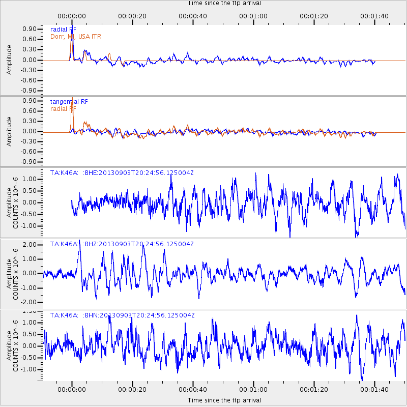
Earthquake location: Queen Charlotte Islands Region
Earthquake latitude/longitude: 51.2/-130.4
Earthquake time(UTC): 2013/09/03 (246) 20:19:06 GMT
Earthquake Depth: 2.7 km
Earthquake Magnitude: 6.1 MWW, 6.0 MWB, 6.1 MWW, 6.1 MWC, 6.2 MI, 6.2 MWC
Earthquake Catalog/Contributor: NEIC PDE/NEIC COMCAT
Network: TA USArray Transportable Network (new EarthScope stations)
Station: K46A Dorr, MI, USA
Lat/Lon: 42.69 N/85.78 W
Elevation: 213 m
Distance: 31.2 deg
Az: 88.189 deg
Baz: 301.565 deg
Ray Param: 0.07913935
Estimated Moho Depth: 42.25 km
Estimated Crust Vp/Vs: 1.60
Assumed Crust Vp: 6.483 km/s
Estimated Crust Vs: 4.045 km/s
Estimated Crust Poisson's Ratio: 0.18
Radial Match: 81.79784 %
Radial Bump: 400
Transverse Match: 58.509125 %
Transverse Bump: 400
SOD ConfigId: 626651
Insert Time: 2014-04-18 08:41:41.100 +0000
GWidth: 2.5
Max Bumps: 400
Tol: 0.001

Signal To Noise

ChannelStoNSTALTA
TA:K46A: :BHZ:20130903T20:24:56.125004Z5.3896198.492409E-71.5756976E-7
TA:K46A: :BHN:20130903T20:24:56.125004Z1.33884383.0191802E-72.2550651E-7
TA:K46A: :BHE:20130903T20:24:56.125004Z1.97906644.2842285E-72.1647725E-7
Arrivals
Ps4.3 SECOND
PpPs15 SECOND
PsPs/PpSs20 SECOND