K48A Perry, MI, USA - Earthquake Result Viewer
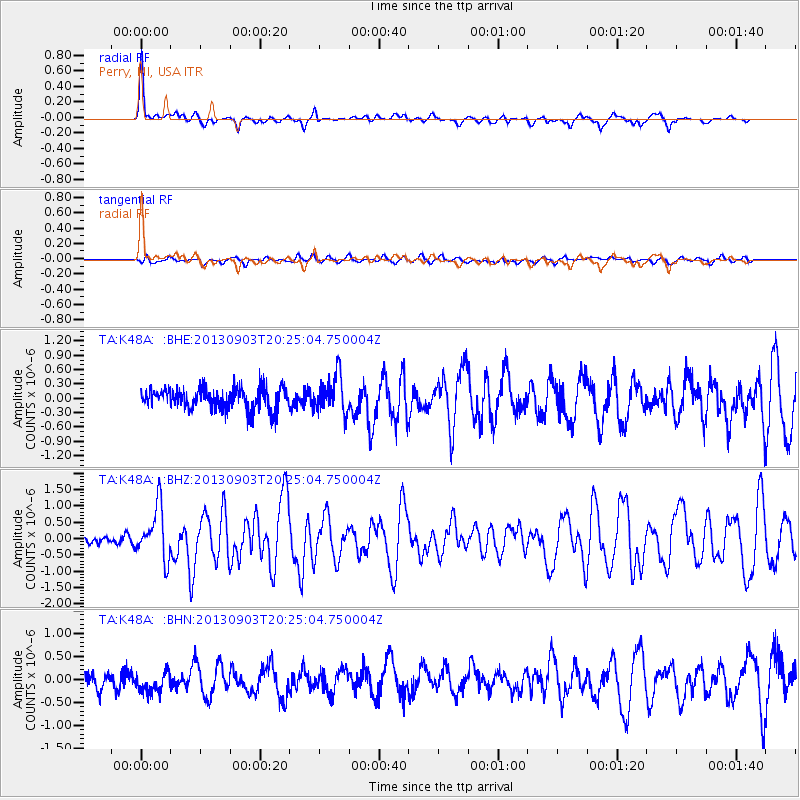
Earthquake location: Queen Charlotte Islands Region
Earthquake latitude/longitude: 51.2/-130.4
Earthquake time(UTC): 2013/09/03 (246) 20:19:06 GMT
Earthquake Depth: 2.7 km
Earthquake Magnitude: 6.1 MWW, 6.0 MWB, 6.1 MWW, 6.1 MWC, 6.2 MI, 6.2 MWC
Earthquake Catalog/Contributor: NEIC PDE/NEIC COMCAT
Network: TA USArray Transportable Network (new EarthScope stations)
Station: K48A Perry, MI, USA
Lat/Lon: 42.80 N/84.12 W
Elevation: 273 m
Distance: 32.2 deg
Az: 86.78 deg
Baz: 301.492 deg
Ray Param: 0.0787719
Estimated Moho Depth: 59.25 km
Estimated Crust Vp/Vs: 1.60
Assumed Crust Vp: 6.483 km/s
Estimated Crust Vs: 4.052 km/s
Estimated Crust Poisson's Ratio: 0.18
Radial Match: 89.49666 %
Radial Bump: 353
Transverse Match: 60.451187 %
Transverse Bump: 400
SOD ConfigId: 626651
Insert Time: 2014-04-18 08:41:46.052 +0000
GWidth: 2.5
Max Bumps: 400
Tol: 0.001

Signal To Noise

ChannelStoNSTALTA
TA:K48A: :BHZ:20130903T20:25:04.750004Z4.54156457.938065E-71.7478703E-7
TA:K48A: :BHN:20130903T20:25:04.750004Z1.09565642.5377034E-72.316149E-7
TA:K48A: :BHE:20130903T20:25:04.750004Z1.72184483.8492115E-72.235516E-7
Arrivals
Ps6.0 SECOND
PpPs22 SECOND
PsPs/PpSs28 SECOND