L46A Eue Claire, MI, USA - Earthquake Result Viewer
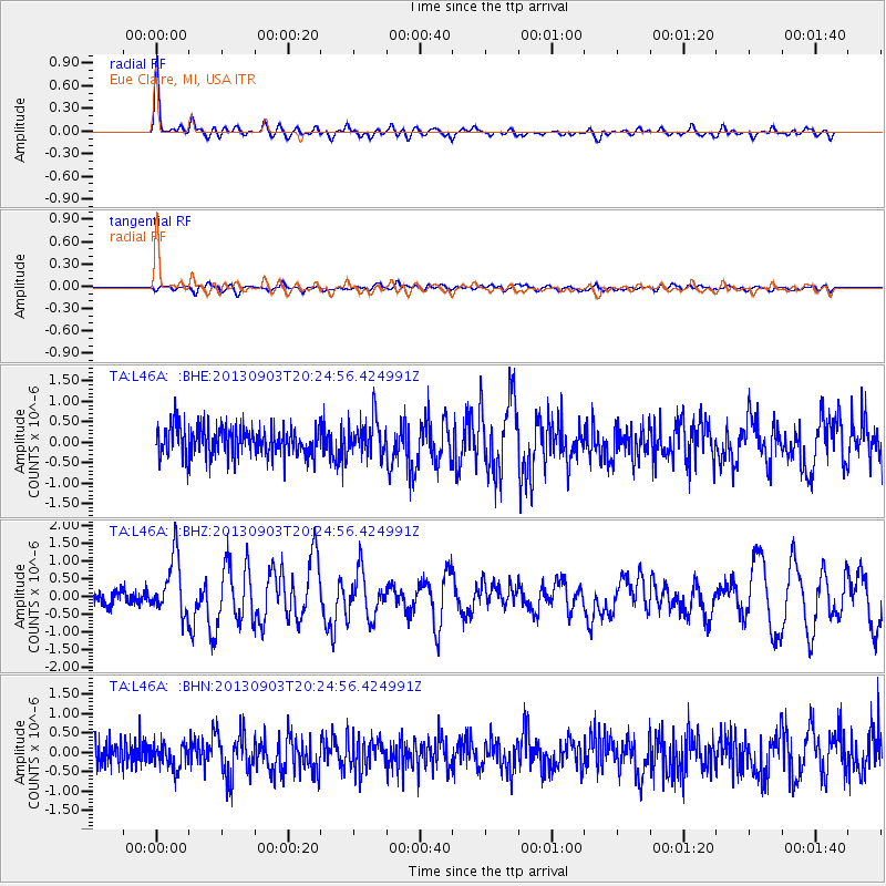
Earthquake location: Queen Charlotte Islands Region
Earthquake latitude/longitude: 51.2/-130.4
Earthquake time(UTC): 2013/09/03 (246) 20:19:06 GMT
Earthquake Depth: 2.7 km
Earthquake Magnitude: 6.1 MWW, 6.0 MWB, 6.1 MWW, 6.1 MWC, 6.2 MI, 6.2 MWC
Earthquake Catalog/Contributor: NEIC PDE/NEIC COMCAT
Network: TA USArray Transportable Network (new EarthScope stations)
Station: L46A Eue Claire, MI, USA
Lat/Lon: 42.01 N/86.30 W
Elevation: 223 m
Distance: 31.2 deg
Az: 89.678 deg
Baz: 302.495 deg
Ray Param: 0.07913009
Estimated Moho Depth: 33.75 km
Estimated Crust Vp/Vs: 2.00
Assumed Crust Vp: 6.483 km/s
Estimated Crust Vs: 3.237 km/s
Estimated Crust Poisson's Ratio: 0.33
Radial Match: 82.97063 %
Radial Bump: 397
Transverse Match: 59.165577 %
Transverse Bump: 400
SOD ConfigId: 626651
Insert Time: 2014-04-18 08:42:09.270 +0000
GWidth: 2.5
Max Bumps: 400
Tol: 0.001

Signal To Noise

ChannelStoNSTALTA
TA:L46A: :BHZ:20130903T20:24:56.424991Z4.1223448.153847E-71.9779637E-7
TA:L46A: :BHN:20130903T20:24:56.424991Z0.821513653.3215625E-74.0432224E-7
TA:L46A: :BHE:20130903T20:24:56.424991Z1.28665084.7090606E-73.6599369E-7
Arrivals
Ps5.6 SECOND
PpPs15 SECOND
PsPs/PpSs20 SECOND