
L48A N Adams, MI, USA - Earthquake Result Viewer
| ||||||||||||||||||
| ||||||||||||||||||
| ||||||||||||||||||
|
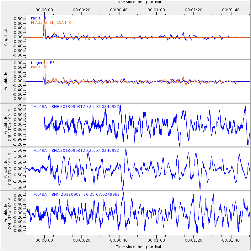
Signal To Noise
| Channel | StoN | STA | LTA |
| TA:L48A: :BHZ:20130903T20:25:07.024998Z | 2.6397123 | 5.17595E-7 | 1.9608008E-7 |
| TA:L48A: :BHN:20130903T20:25:07.024998Z | 1.7700784 | 2.6168541E-7 | 1.4783832E-7 |
| TA:L48A: :BHE:20130903T20:25:07.024998Z | 1.669904 | 4.13374E-7 | 2.475436E-7 |
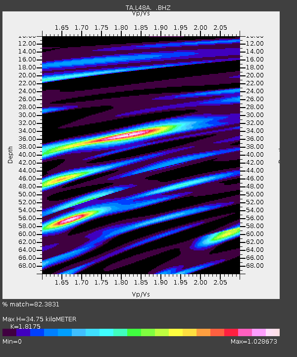
| Arrivals | |
| Ps | 4.7 SECOND |
| PpPs | 14 SECOND |
| PsPs/PpSs | 19 SECOND |

