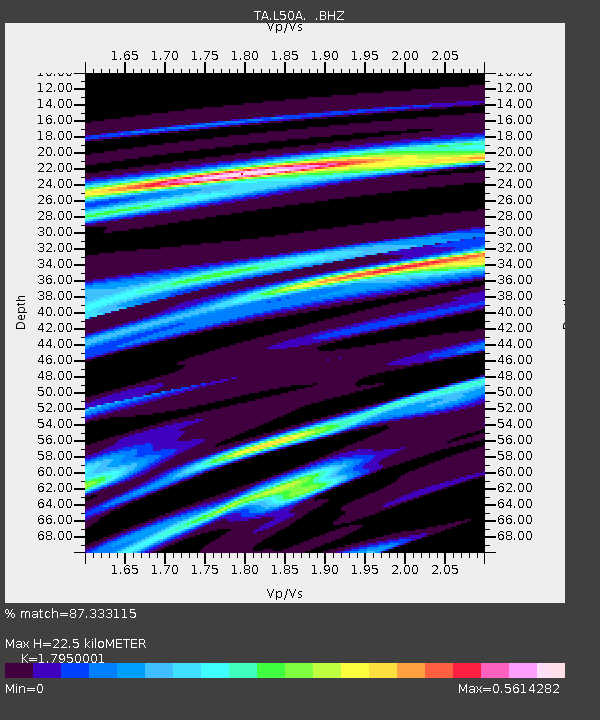
L50A Kingsville, ON, CAN - Earthquake Result Viewer
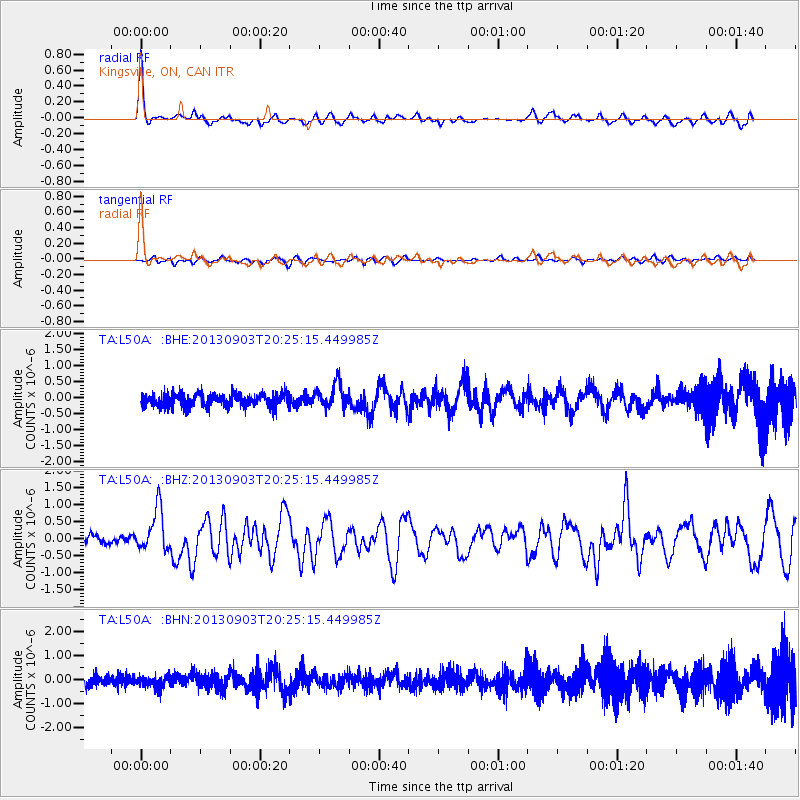
Earthquake location: Queen Charlotte Islands Region
Earthquake latitude/longitude: 51.2/-130.4
Earthquake time(UTC): 2013/09/03 (246) 20:19:06 GMT
Earthquake Depth: 2.7 km
Earthquake Magnitude: 6.1 MWW, 6.0 MWB, 6.1 MWW, 6.1 MWC, 6.2 MI, 6.2 MWC
Earthquake Catalog/Contributor: NEIC PDE/NEIC COMCAT
Network: TA USArray Transportable Network (new EarthScope stations)
Station: L50A Kingsville, ON, CAN
Lat/Lon: 42.04 N/82.81 W
Elevation: 187 m
Distance: 33.4 deg
Az: 87.019 deg
Baz: 302.573 deg
Ray Param: 0.07823376
Estimated Moho Depth: 22.5 km
Estimated Crust Vp/Vs: 1.80
Assumed Crust Vp: 6.483 km/s
Estimated Crust Vs: 3.611 km/s
Estimated Crust Poisson's Ratio: 0.27
Radial Match: 87.333115 %
Radial Bump: 396
Transverse Match: 60.705776 %
Transverse Bump: 400
SOD ConfigId: 626651
Insert Time: 2014-04-18 08:42:18.617 +0000
GWidth: 2.5
Max Bumps: 400
Tol: 0.001

Signal To Noise

ChannelStoNSTALTA
TA:L50A: :BHZ:20130903T20:25:15.449985Z3.85339266.226368E-71.6158145E-7
TA:L50A: :BHN:20130903T20:25:15.449985Z0.94724152.4293357E-72.5646423E-7
TA:L50A: :BHE:20130903T20:25:15.449985Z1.78732563.6940153E-72.0667835E-7
Arrivals
Ps3.0 SECOND
PpPs9.0 SECOND
PsPs/PpSs12 SECOND