
L56A Greenwood, NY, USA - Earthquake Result Viewer
| ||||||||||||||||||
| ||||||||||||||||||
| ||||||||||||||||||
|
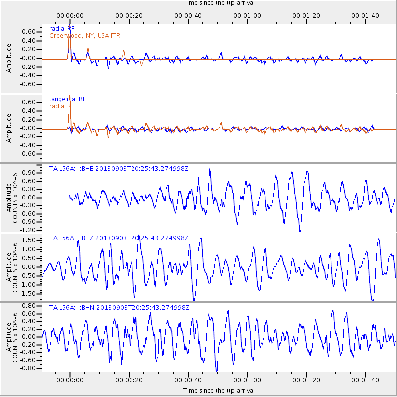
Signal To Noise
| Channel | StoN | STA | LTA |
| TA:L56A: :BHZ:20130903T20:25:43.274998Z | 3.08337 | 6.7297606E-7 | 2.1825991E-7 |
| TA:L56A: :BHN:20130903T20:25:43.274998Z | 1.380235 | 2.6112315E-7 | 1.8918746E-7 |
| TA:L56A: :BHE:20130903T20:25:43.274998Z | 1.6788232 | 2.4914837E-7 | 1.4840656E-7 |
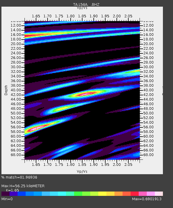
| Arrivals | |
| Ps | 6.1 SECOND |
| PpPs | 21 SECOND |
| PsPs/PpSs | 27 SECOND |

