L57A Andrews Acres Farm, Gillet, PA, USA - Earthquake Result Viewer
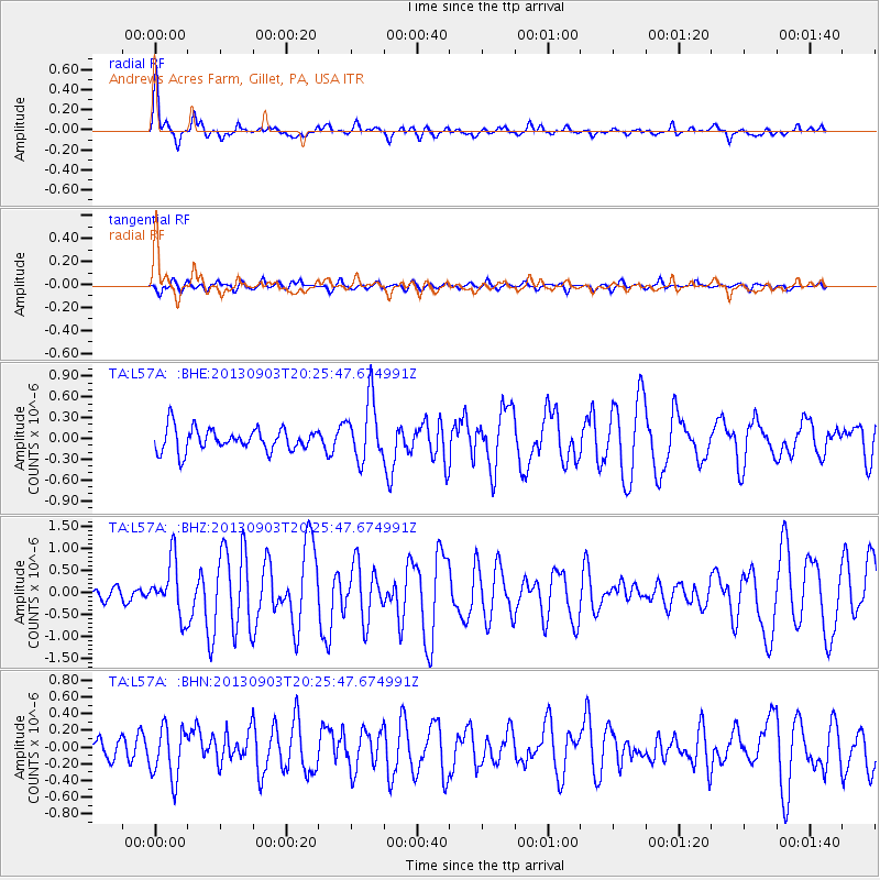
Earthquake location: Queen Charlotte Islands Region
Earthquake latitude/longitude: 51.2/-130.4
Earthquake time(UTC): 2013/09/03 (246) 20:19:06 GMT
Earthquake Depth: 2.7 km
Earthquake Magnitude: 6.1 MWW, 6.0 MWB, 6.1 MWW, 6.1 MWC, 6.2 MI, 6.2 MWC
Earthquake Catalog/Contributor: NEIC PDE/NEIC COMCAT
Network: TA USArray Transportable Network (new EarthScope stations)
Station: L57A Andrews Acres Farm, Gillet, PA, USA
Lat/Lon: 42.00 N/76.85 W
Elevation: 546 m
Distance: 37.2 deg
Az: 82.908 deg
Baz: 303.192 deg
Ray Param: 0.076300316
Estimated Moho Depth: 40.5 km
Estimated Crust Vp/Vs: 1.90
Assumed Crust Vp: 6.476 km/s
Estimated Crust Vs: 3.404 km/s
Estimated Crust Poisson's Ratio: 0.31
Radial Match: 85.34832 %
Radial Bump: 400
Transverse Match: 68.973816 %
Transverse Bump: 400
SOD ConfigId: 626651
Insert Time: 2014-04-18 08:42:30.752 +0000
GWidth: 2.5
Max Bumps: 400
Tol: 0.001

Signal To Noise

ChannelStoNSTALTA
TA:L57A: :BHZ:20130903T20:25:47.674991Z2.70912226.163659E-72.27515E-7
TA:L57A: :BHN:20130903T20:25:47.674991Z2.4223343.0951526E-71.2777564E-7
TA:L57A: :BHE:20130903T20:25:47.674991Z2.6566324.367669E-71.6440625E-7
Arrivals
Ps6.1 SECOND
PpPs17 SECOND
PsPs/PpSs23 SECOND