M47A Cromwell, IN, USA - Earthquake Result Viewer
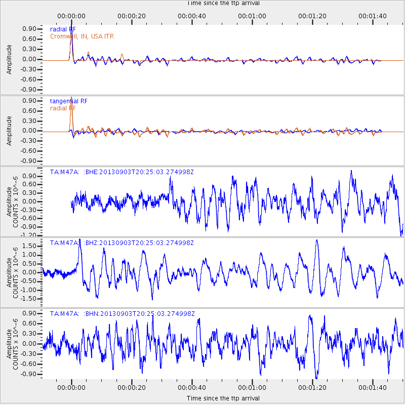
Earthquake location: Queen Charlotte Islands Region
Earthquake latitude/longitude: 51.2/-130.4
Earthquake time(UTC): 2013/09/03 (246) 20:19:06 GMT
Earthquake Depth: 2.7 km
Earthquake Magnitude: 6.1 MWW, 6.0 MWB, 6.1 MWW, 6.1 MWC, 6.2 MI, 6.2 MWC
Earthquake Catalog/Contributor: NEIC PDE/NEIC COMCAT
Network: TA USArray Transportable Network (new EarthScope stations)
Station: M47A Cromwell, IN, USA
Lat/Lon: 41.36 N/85.62 W
Elevation: 283 m
Distance: 32.0 deg
Az: 90.2 deg
Baz: 303.386 deg
Ray Param: 0.078844085
Estimated Moho Depth: 13.25 km
Estimated Crust Vp/Vs: 2.10
Assumed Crust Vp: 6.498 km/s
Estimated Crust Vs: 3.098 km/s
Estimated Crust Poisson's Ratio: 0.35
Radial Match: 88.149826 %
Radial Bump: 311
Transverse Match: 67.78636 %
Transverse Bump: 400
SOD ConfigId: 626651
Insert Time: 2014-04-18 08:42:37.945 +0000
GWidth: 2.5
Max Bumps: 400
Tol: 0.001

Signal To Noise

ChannelStoNSTALTA
TA:M47A: :BHZ:20130903T20:25:03.274998Z6.18089637.4241507E-71.2011446E-7
TA:M47A: :BHN:20130903T20:25:03.274998Z1.75586432.4838073E-71.4145783E-7
TA:M47A: :BHE:20130903T20:25:03.274998Z1.99703063.3085323E-71.6567259E-7
Arrivals
Ps2.4 SECOND
PpPs5.9 SECOND
PsPs/PpSs8.3 SECOND