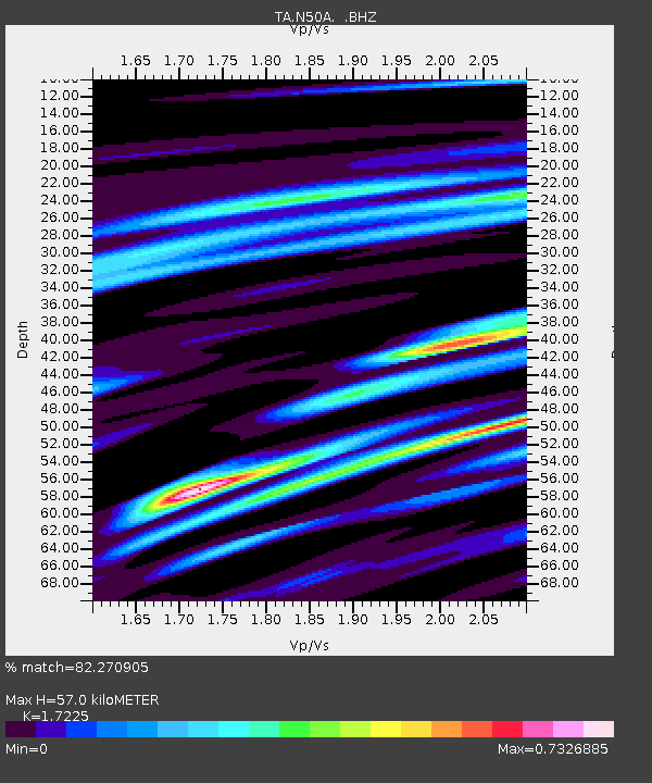
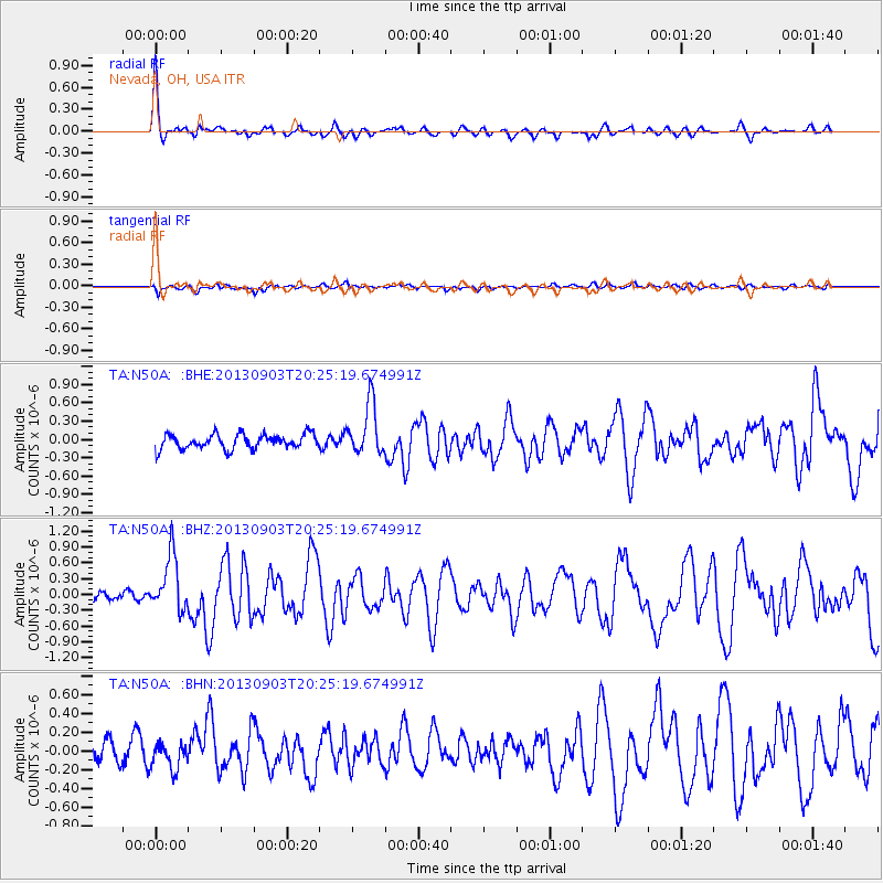
N50A Nevada, OH, USA - Earthquake Result Viewer

Earthquake location: Queen Charlotte Islands Region
Earthquake latitude/longitude: 51.2/-130.4
Earthquake time(UTC): 2013/09/03 (246) 20:19:06 GMT
Earthquake Depth: 2.7 km
Earthquake Magnitude: 6.1 MWW, 6.0 MWB, 6.1 MWW, 6.1 MWC, 6.2 MI, 6.2 MWC
Earthquake Catalog/Contributor: NEIC PDE/NEIC COMCAT
Network: TA USArray Transportable Network (new EarthScope stations)
Station: N50A Nevada, OH, USA
Lat/Lon: 40.77 N/83.15 W
Elevation: 277 m
Distance: 33.9 deg
Az: 89.187 deg
Baz: 304.154 deg
Ray Param: 0.07800996
Estimated Moho Depth: 57.0 km
Estimated Crust Vp/Vs: 1.72
Assumed Crust Vp: 6.498 km/s
Estimated Crust Vs: 3.772 km/s
Estimated Crust Poisson's Ratio: 0.25
Radial Match: 82.270905 %
Radial Bump: 336
Transverse Match: 52.657795 %
Transverse Bump: 400
SOD ConfigId: 626651
Insert Time: 2014-04-18 08:43:14.470 +0000
GWidth: 2.5
Max Bumps: 400
Tol: 0.001

Signal To Noise

ChannelStoNSTALTA
TA:N50A: :BHZ:20130903T20:25:19.674991Z4.56409035.294243E-71.1599777E-7
TA:N50A: :BHN:20130903T20:25:19.674991Z1.32997441.3836836E-71.04038364E-7
TA:N50A: :BHE:20130903T20:25:19.674991Z3.53312254.2116685E-71.19205275E-7
Arrivals
Ps6.9 SECOND
PpPs22 SECOND
PsPs/PpSs29 SECOND