You are here: Home > Network List > TA - USArray Transportable Network (new EarthScope stations) Stations List
> Station N51A Ashland, OH, USA > Earthquake Result Viewer
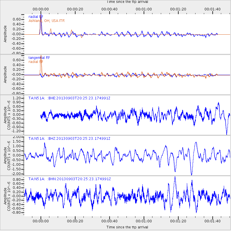
N51A Ashland, OH, USA - Earthquake Result Viewer
*The percent match for this event was below the threshold and hence no stack was calculated.
| Earthquake location: |
Queen Charlotte Islands Region |
| Earthquake latitude/longitude: |
51.2/-130.4 |
| Earthquake time(UTC): |
2013/09/03 (246) 20:19:06 GMT |
| Earthquake Depth: |
2.7 km |
| Earthquake Magnitude: |
6.1 MWW, 6.0 MWB, 6.1 MWW, 6.1 MWC, 6.2 MI, 6.2 MWC |
| Earthquake Catalog/Contributor: |
NEIC PDE/NEIC COMCAT |
|
| Network: |
TA USArray Transportable Network (new EarthScope stations) |
| Station: |
N51A Ashland, OH, USA |
| Lat/Lon: |
40.92 N/82.37 W |
| Elevation: |
343 m |
|
| Distance: |
34.3 deg |
| Az: |
88.383 deg |
| Baz: |
303.993 deg |
| Ray Param: |
$rayparam |
*The percent match for this event was below the threshold and hence was not used in the summary stack. |
|
| Radial Match: |
77.1236 % |
| Radial Bump: |
400 |
| Transverse Match: |
50.07052 % |
| Transverse Bump: |
400 |
| SOD ConfigId: |
626651 |
| Insert Time: |
2014-04-18 08:43:18.550 +0000 |
| GWidth: |
2.5 |
| Max Bumps: |
400 |
| Tol: |
0.001 |
|
Signal To Noise
| Channel | StoN | STA | LTA |
| TA:N51A: :BHZ:20130903T20:25:23.174991Z | 3.1944096 | 5.1710725E-7 | 1.6187882E-7 |
| TA:N51A: :BHN:20130903T20:25:23.174991Z | 1.6062196 | 2.2237248E-7 | 1.3844463E-7 |
| TA:N51A: :BHE:20130903T20:25:23.174991Z | 1.6654648 | 2.6203642E-7 | 1.5733531E-7 |
| Arrivals |
| Ps | |
| PpPs | |
| PsPs/PpSs | |


