You are here: Home > Network List > TA - USArray Transportable Network (new EarthScope stations) Stations List
> Station N59A State Game Land 141, Hazleton, PA, USA > Earthquake Result Viewer
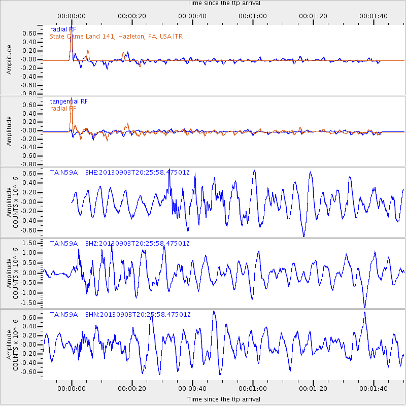
N59A State Game Land 141, Hazleton, PA, USA - Earthquake Result Viewer
*The percent match for this event was below the threshold and hence no stack was calculated.
| Earthquake location: |
Queen Charlotte Islands Region |
| Earthquake latitude/longitude: |
51.2/-130.4 |
| Earthquake time(UTC): |
2013/09/03 (246) 20:19:06 GMT |
| Earthquake Depth: |
2.7 km |
| Earthquake Magnitude: |
6.1 MWW, 6.0 MWB, 6.1 MWW, 6.1 MWC, 6.2 MI, 6.2 MWC |
| Earthquake Catalog/Contributor: |
NEIC PDE/NEIC COMCAT |
|
| Network: |
TA USArray Transportable Network (new EarthScope stations) |
| Station: |
N59A State Game Land 141, Hazleton, PA, USA |
| Lat/Lon: |
40.92 N/75.77 W |
| Elevation: |
508 m |
|
| Distance: |
38.4 deg |
| Az: |
83.639 deg |
| Baz: |
304.481 deg |
| Ray Param: |
$rayparam |
*The percent match for this event was below the threshold and hence was not used in the summary stack. |
|
| Radial Match: |
79.145065 % |
| Radial Bump: |
400 |
| Transverse Match: |
66.7831 % |
| Transverse Bump: |
400 |
| SOD ConfigId: |
626651 |
| Insert Time: |
2014-04-18 08:43:34.462 +0000 |
| GWidth: |
2.5 |
| Max Bumps: |
400 |
| Tol: |
0.001 |
|
Signal To Noise
| Channel | StoN | STA | LTA |
| TA:N59A: :BHZ:20130903T20:25:58.47501Z | 2.6733394 | 4.230965E-7 | 1.5826517E-7 |
| TA:N59A: :BHN:20130903T20:25:58.47501Z | 1.2381628 | 1.4294959E-7 | 1.15452984E-7 |
| TA:N59A: :BHE:20130903T20:25:58.47501Z | 1.2377768 | 2.2717464E-7 | 1.8353441E-7 |
| Arrivals |
| Ps | |
| PpPs | |
| PsPs/PpSs | |


