O44A Mansfield, IL, USA - Earthquake Result Viewer
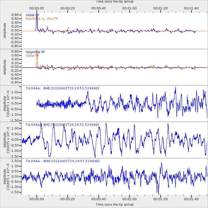
Earthquake location: Queen Charlotte Islands Region
Earthquake latitude/longitude: 51.2/-130.4
Earthquake time(UTC): 2013/09/03 (246) 20:19:06 GMT
Earthquake Depth: 2.7 km
Earthquake Magnitude: 6.1 MWW, 6.0 MWB, 6.1 MWW, 6.1 MWC, 6.2 MI, 6.2 MWC
Earthquake Catalog/Contributor: NEIC PDE/NEIC COMCAT
Network: TA USArray Transportable Network (new EarthScope stations)
Station: O44A Mansfield, IL, USA
Lat/Lon: 40.15 N/88.47 W
Elevation: 213 m
Distance: 30.9 deg
Az: 94.44 deg
Baz: 305.153 deg
Ray Param: 0.07921673
Estimated Moho Depth: 21.5 km
Estimated Crust Vp/Vs: 1.74
Assumed Crust Vp: 6.498 km/s
Estimated Crust Vs: 3.734 km/s
Estimated Crust Poisson's Ratio: 0.25
Radial Match: 83.70332 %
Radial Bump: 400
Transverse Match: 58.82623 %
Transverse Bump: 400
SOD ConfigId: 626651
Insert Time: 2014-04-18 08:43:39.469 +0000
GWidth: 2.5
Max Bumps: 400
Tol: 0.001

Signal To Noise

ChannelStoNSTALTA
TA:O44A: :BHZ:20130903T20:24:53.524998Z4.12702136.176984E-71.4967173E-7
TA:O44A: :BHN:20130903T20:24:53.524998Z2.1380574.1293018E-71.9313339E-7
TA:O44A: :BHE:20130903T20:24:53.524998Z2.49608184.456169E-71.7852656E-7
Arrivals
Ps2.7 SECOND
PpPs8.3 SECOND
PsPs/PpSs11 SECOND