P46A Rosedale, IN, USA - Earthquake Result Viewer
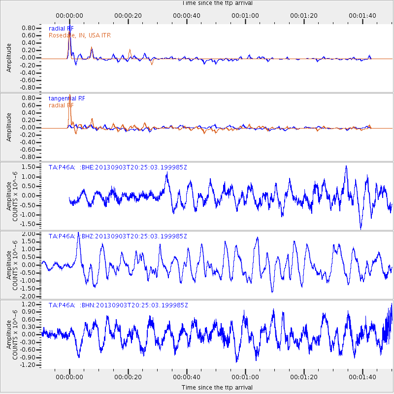
Earthquake location: Queen Charlotte Islands Region
Earthquake latitude/longitude: 51.2/-130.4
Earthquake time(UTC): 2013/09/03 (246) 20:19:06 GMT
Earthquake Depth: 2.7 km
Earthquake Magnitude: 6.1 MWW, 6.0 MWB, 6.1 MWW, 6.1 MWC, 6.2 MI, 6.2 MWC
Earthquake Catalog/Contributor: NEIC PDE/NEIC COMCAT
Network: TA USArray Transportable Network (new EarthScope stations)
Station: P46A Rosedale, IN, USA
Lat/Lon: 39.62 N/87.21 W
Elevation: 194 m
Distance: 32.0 deg
Az: 94.196 deg
Baz: 305.749 deg
Ray Param: 0.078847766
Estimated Moho Depth: 11.25 km
Estimated Crust Vp/Vs: 1.72
Assumed Crust Vp: 6.444 km/s
Estimated Crust Vs: 3.741 km/s
Estimated Crust Poisson's Ratio: 0.25
Radial Match: 88.427155 %
Radial Bump: 335
Transverse Match: 43.454617 %
Transverse Bump: 400
SOD ConfigId: 626651
Insert Time: 2014-04-18 08:44:12.307 +0000
GWidth: 2.5
Max Bumps: 400
Tol: 0.001

Signal To Noise

ChannelStoNSTALTA
TA:P46A: :BHZ:20130903T20:25:03.199985Z6.10924538.198972E-71.3420598E-7
TA:P46A: :BHN:20130903T20:25:03.199985Z2.38403653.543956E-71.486536E-7
TA:P46A: :BHE:20130903T20:25:03.199985Z2.36048845.254054E-72.2258335E-7
Arrivals
Ps1.4 SECOND
PpPs4.4 SECOND
PsPs/PpSs5.7 SECOND