You are here: Home > Network List > TA - USArray Transportable Network (new EarthScope stations) Stations List
> Station 121A Cookes Peak, Deming, NM, USA > Earthquake Result Viewer
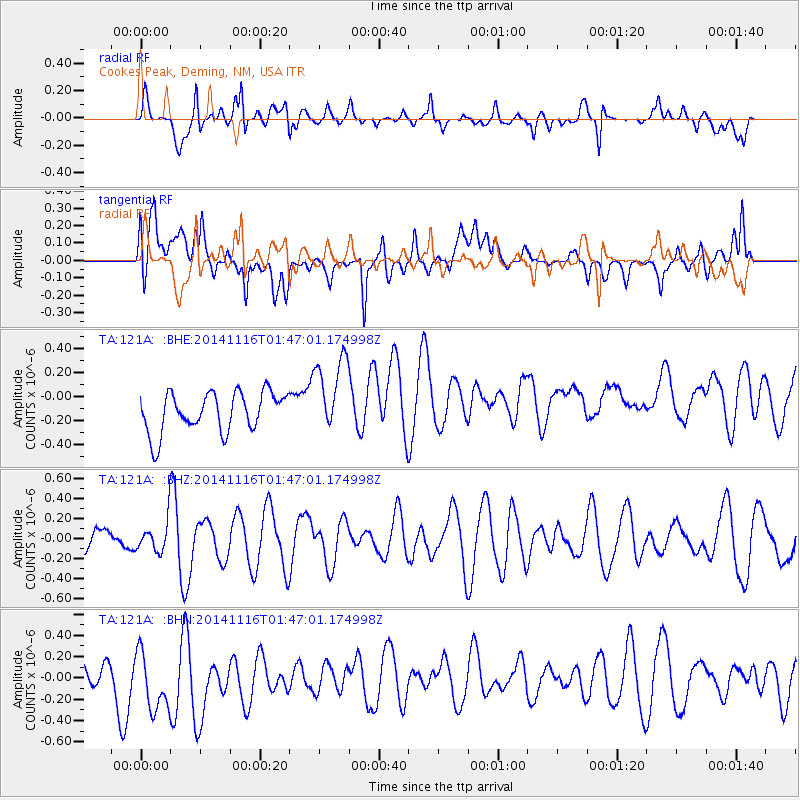
121A Cookes Peak, Deming, NM, USA - Earthquake Result Viewer
*The percent match for this event was below the threshold and hence no stack was calculated.
| Earthquake location: |
Iceland |
| Earthquake latitude/longitude: |
64.7/-17.6 |
| Earthquake time(UTC): |
2014/11/16 (320) 01:37:17 GMT |
| Earthquake Depth: |
10 km |
| Earthquake Magnitude: |
5.3 MW, 5.0 mb, 5.0 MS |
| Earthquake Catalog/Contributor: |
ISC/ISC |
|
| Network: |
TA USArray Transportable Network (new EarthScope stations) |
| Station: |
121A Cookes Peak, Deming, NM, USA |
| Lat/Lon: |
32.53 N/107.79 W |
| Elevation: |
1652 m |
|
| Distance: |
61.2 deg |
| Az: |
285.418 deg |
| Baz: |
29.398 deg |
| Ray Param: |
$rayparam |
*The percent match for this event was below the threshold and hence was not used in the summary stack. |
|
| Radial Match: |
64.27926 % |
| Radial Bump: |
400 |
| Transverse Match: |
49.619072 % |
| Transverse Bump: |
400 |
| SOD ConfigId: |
3390531 |
| Insert Time: |
2019-04-15 00:50:37.857 +0000 |
| GWidth: |
2.5 |
| Max Bumps: |
400 |
| Tol: |
0.001 |
|
Signal To Noise
| Channel | StoN | STA | LTA |
| TA:121A: :BHZ:20141116T01:47:01.174998Z | 0.717868 | 1.5718658E-7 | 2.1896308E-7 |
| TA:121A: :BHN:20141116T01:47:01.174998Z | 1.8186083 | 3.413079E-7 | 1.8767533E-7 |
| TA:121A: :BHE:20141116T01:47:01.174998Z | 2.0100017 | 3.2919507E-7 | 1.6377851E-7 |
| Arrivals |
| Ps | |
| PpPs | |
| PsPs/PpSs | |


