
P53A Whipple, OH, USA - Earthquake Result Viewer
| ||||||||||||||||||
| ||||||||||||||||||
| ||||||||||||||||||
|
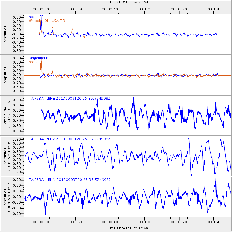
Signal To Noise
| Channel | StoN | STA | LTA |
| TA:P53A: :BHZ:20130903T20:25:35.524998Z | 2.3712852 | 4.819183E-7 | 2.0323084E-7 |
| TA:P53A: :BHN:20130903T20:25:35.524998Z | 2.3608136 | 3.3329013E-7 | 1.4117596E-7 |
| TA:P53A: :BHE:20130903T20:25:35.524998Z | 2.153106 | 4.0111595E-7 | 1.8629643E-7 |
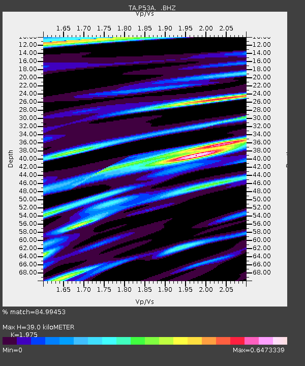
| Arrivals | |
| Ps | 6.5 SECOND |
| PpPs | 18 SECOND |
| PsPs/PpSs | 24 SECOND |

