You are here: Home > Network List > TA - USArray Transportable Network (new EarthScope stations) Stations List
> Station P55A Reedsville, WV, USA > Earthquake Result Viewer
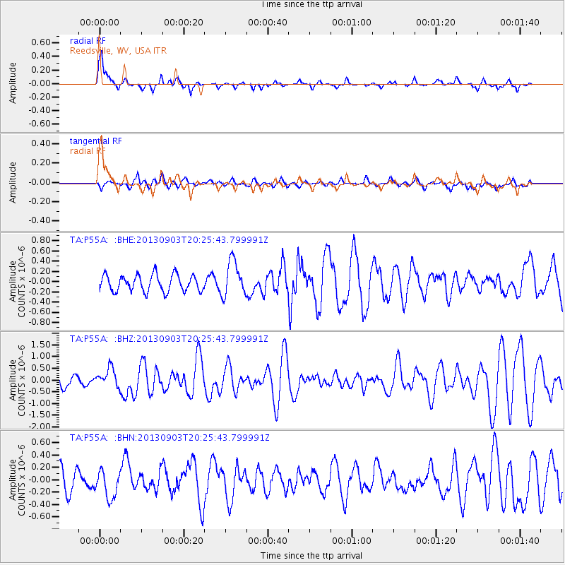
P55A Reedsville, WV, USA - Earthquake Result Viewer
*The percent match for this event was below the threshold and hence no stack was calculated.
| Earthquake location: |
Queen Charlotte Islands Region |
| Earthquake latitude/longitude: |
51.2/-130.4 |
| Earthquake time(UTC): |
2013/09/03 (246) 20:19:06 GMT |
| Earthquake Depth: |
2.7 km |
| Earthquake Magnitude: |
6.1 MWW, 6.0 MWB, 6.1 MWW, 6.1 MWC, 6.2 MI, 6.2 MWC |
| Earthquake Catalog/Contributor: |
NEIC PDE/NEIC COMCAT |
|
| Network: |
TA USArray Transportable Network (new EarthScope stations) |
| Station: |
P55A Reedsville, WV, USA |
| Lat/Lon: |
39.51 N/79.83 W |
| Elevation: |
551 m |
|
| Distance: |
36.7 deg |
| Az: |
88.454 deg |
| Baz: |
305.69 deg |
| Ray Param: |
$rayparam |
*The percent match for this event was below the threshold and hence was not used in the summary stack. |
|
| Radial Match: |
76.068596 % |
| Radial Bump: |
332 |
| Transverse Match: |
65.02893 % |
| Transverse Bump: |
400 |
| SOD ConfigId: |
626651 |
| Insert Time: |
2014-04-18 08:44:31.082 +0000 |
| GWidth: |
2.5 |
| Max Bumps: |
400 |
| Tol: |
0.001 |
|
Signal To Noise
| Channel | StoN | STA | LTA |
| TA:P55A: :BHZ:20130903T20:25:43.799991Z | 1.602167 | 4.115344E-7 | 2.5686109E-7 |
| TA:P55A: :BHN:20130903T20:25:43.799991Z | 1.3702818 | 2.2127078E-7 | 1.614783E-7 |
| TA:P55A: :BHE:20130903T20:25:43.799991Z | 2.169 | 3.4977288E-7 | 1.6125998E-7 |
| Arrivals |
| Ps | |
| PpPs | |
| PsPs/PpSs | |


